Area Overview for PH38 4LZ
Photos of PH38 4LZ
Area Information
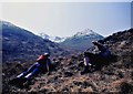
PH38 4LZ represents a specific postcode cluster in Scotland covering an expansive 96.3 square kilometres. This large geographic footprint suggests a spread-out residential environment rather than a dense urban street. Living in PH38 4LZ involves navigating a vast landscape where proximity to specific services can vary significantly from one end of the postcode to another. The area stands apart from typical town centres due to its sheer size, which accommodates housing developments across a wide patch of terrain. Residents here likely experience a quieter, more dispersed way of life compared to a tightly packed inner-city neighbourhood. You will find yourself dealing with greater distances between your home and local hubs. The designation as a small residential cluster within such a large area emphasises the importance of your exact address within the PH38 4LZ envelope. Daily routines may require careful planning to ensure you are within reasonable travelling time of essential facilities. The sheer scale of this terrain shapes the identity of PH38 4LZ as a place defined by space and locality rather than compact density.
- Area Type
- Postcode
- Area Size
- 96.3 km²
- Population
- Not available
- Population Density
- Not available
Detailed statistics on the property market for PH38 4LZ are not available in the provided records. You cannot confirm the percentage of owner-occupied homes or identify the predominant accommodation types for this specific postcode. Market data typically reveals whether a neighbourhood leans towards owner-occupation or private renting, but those specific figures are missing here. Buyers viewing homes in PH38 4LZ must navigate without knowing the exact mix of terraced houses, flats, or detached bungalows. The area's vast size of 96.3 square kilometres implies a significant variation in property types across the boundary, even if local averages are unknown. General knowledge of Scottish postcodes suggests a high likelihood of detached or semi-detached family homes in such expansive zones. However, without concrete percentages on housing tenure or specific counts of flats or terraced houses, any statement regarding the market composition remains an inference. You must treat the housing options in PH38 4LZ as highly variable based on your specific address within the cluster.
House Prices in PH38 4LZ
Showing 36 properties
Energy Efficiency in PH38 4LZ
Daily life in PH38 4LZ revolves around practical accessibility to surrounding transport hubs and specific rail stations. The nearest rail connections include Lochailort Railway Station, Beasdale Railway Station, and Glenfinnan Railway Station. These three stations offer the primary public transport links for residents travelling beyond the immediate postcode area. Living here means planning journeys through the Scottish Highlands to reach these specific termini. You will need to verify schedules for the nearest station relative to your specific address within the 96.3 square kilometre zone. These rail options connect you to wider regional networks, but the distance to each station will define your daily commute pattern. There is no data available regarding local shops, dining venues, or leisure centres within the immediate vicinity of PH38 4LZ. Your lifestyle choices will therefore depend heavily on the proximity to these named railway locations and the wider countryside surrounding the postcode cluster.
Amenities
Schools
| Rank | School | Type | Entry gender | Ages |
|---|
Explore more schools in this area
Go to Schools tabDemographics
Specific demographic figures for PH38 4LZ are not provided in the current dataset. Without access to detailed census data, you cannot determine the exact age profile or household composition of the community. The available information does not break down home ownership levels or the diversity of the population within this postcode. You also lack data on the specific types of accommodation that dominate the housing stock in PH38 4LZ. This absence of granular statistics makes it difficult to construct a precise picture of the people living here. However, the known physical size of 96.3 square kilometres offers context. The area contains a mix of properties typical for such a large rural or semi-rural cluster in Scotland. Future buyers must rely on general knowledge of the Scottish Highlands region to infer likely community characteristics rather than relying on localised numbers. The lack of recorded deprivation data further limits the ability to assess the socioeconomic status of the residents in this specific location.
Household Size
Accommodation Type
Tenure
Ethnic Group
Religion
Household Composition
Age
Household Deprivation
NS-SEC
Explore more demographic insights in this area
Go to Demographics tabPlanning
Planning Constraints
- Flood RiskPremium
- Ramsar Wetland SitesPremium
- Area of Outstanding Natural BeautyPremium
- Protected Nature ReservePremium
- Protected WoodlandPremium
- Crime RiskPremium