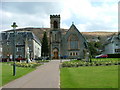
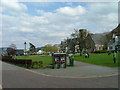
Area Overview for PH33 6FG
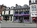
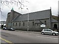
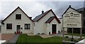
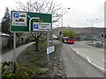
Photos of PH33 6FG


Area Information
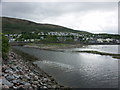
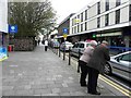
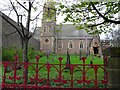
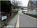
Living in PH33 6FG offers a unique experience within a compact residential cluster that spans just 1.3 hectares. This postcode is situated entirely in Scotland, presenting a distinct character separate from its English counterparts. Your daily life here revolves around a tightly bound community where proximity defines convenience. The area does not stretch far, ensuring that essential services and transport links are within immediate practical reach. Residents enjoy a setting that balances the quiet of a small cluster with the accessibility of major local infrastructure. You do not need to travel far to access supermarkets, train stations, or ferry crossings. This specific postcode covers a small, defined zone, avoiding the sprawl found in larger developments. Instead, you find a focused living environment where neighbours are close at hand. The location serves as a strategic point for those who value short commutes to Fort William while maintaining a peaceful home base. Every house in this area benefits from being part of this concentrated, easy-to-navigate neighbourhood.
- Area Type
- Postcode
- Area Size
- 1.3 hectares
- Population
- Not available
- Population Density
- Not available
The specific data detailing the property market for PH33 6FG, including home ownership percentages or the distribution of accommodation types, is not available. You cannot know from the provided figures whether this postcode consists mainly of terraced flats, detached houses, or a mix of property styles. The lack of tenure data means you cannot assess if this is an area dominated by owners or long-term tenants. Without specific statistics on the number of residential properties or their condition, the housing stock remains a blank sample for analysis. Standard reporting on the types of homes found within these 1.3 hectares is missing from the current dataset. Consequently, you must look to external sources for pricing trends or rental yields. The absence of this market information does not diminish the location's utility but does limit the depth of a statistical overview. Buyers should be prepared to conduct their own due diligence on individual properties within the PG33 6FG boundary to understand the true nature of the local stock.
House Prices in PH33 6FG
Showing 14 properties
| Address | Type | Beds | Baths | Last Sale Price | Last Sale Date | |
|---|---|---|---|---|---|---|
| Fort William The Craigs Burial Ground, Belford Road, Fort William, PH33 6FG | commercial | - | - | - | - | |
| 11 Belhaven Drive, Fort William, PH33 6FG | Semi-detached | - | - | - | - | |
| 1 Belhaven Drive, Fort William, PH33 6FG | Flat | - | - | - | - | |
| 3 Belhaven Drive, Fort William, PH33 6FG | Flat | - | - | - | - | |
| 6 Belhaven Drive, Fort William, PH33 6FG | Flat | - | - | - | - | |
| 4 Belhaven Drive, Fort William, PH33 6FG | Flat | - | - | - | - | |
| 13 Belhaven Drive, Fort William, PH33 6FG | Detached | - | - | - | - | |
| 2 Belhaven Drive, Fort William, PH33 6FG | Flat | - | - | - | - | |
| 7 Belhaven Drive, Fort William, PH33 6FG | Flat | - | - | - | - | |
| 9 Belhaven Drive, Fort William, PH33 6FG | Detached | - | - | - | - |
Energy Efficiency in PH33 6FG
Living in PH33 6FG places you within striking distance of key retail and transport hubs. You have several major supermarkets accessible nearby, including Lidl Fort, Morrisons Fort, and Tesco Fort. These five retail options ensure your weekly shop requires only a short drive. For travel, four railway stations serve the region, notably Fort William Railway Station, Banavie Railway Station, and Corpach Railway Station. These links connect you to wider transport networks. Additionally, two ferry locations are within practical reach: Fort William Ferry Landing and Camusnagaul Ferry Landing. This combination of rail and ferry access simplifies your commute to the Highlands. You do not need to rely on public buses for your main travel needs. The area's lifestyle is defined by this direct access to major hubs like the Fort. Daily errands are manageable, and leisure trips are a short drive away. The presence of these specific venues anchors the convenience of living in this postcode.
Amenities
Schools
| Rank | School | Type | Entry gender | Ages |
|---|
Explore more schools in this area
Go to Schools tabDemographics
Specific census data regarding age, household types, or deprivation levels for PH33 6FG is not included in the current records. Without these figures, it is impossible to describe the precise age profile or the mix of families versus single occupants in this postcode. You cannot determine the exact percentage of owner-occupiers or the diversity of the population without these statistics. The available information simply reflects the limitations of the dataset rather than the actual residents of PH33 6FG. While the area covers 1.3 hectares, the lack of demographic breakdown means we cannot assert who currently lives there in terms of income or tenure. Any assumption about the age range of residents would be a guess without supporting numbers. The absence of such data prevents a detailed analysis of the community's social structure or economic standing. Homebuyers should note that standard demographic metrics are not available for this specific small cluster in the provided information.
Household Size
Accommodation Type
Tenure
Ethnic Group
Religion
Household Composition
Age
Household Deprivation
NS-SEC
Explore more demographic insights in this area
Go to Demographics tabPlanning
Planning Constraints
- Flood RiskPremium
- Ramsar Wetland SitesPremium
- Area of Outstanding Natural BeautyPremium
- Protected Nature ReservePremium
- Protected WoodlandPremium
- Crime RiskPremium