Area Overview for IV2 6TU
Photos of IV2 6TU
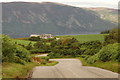
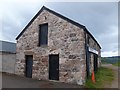
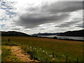
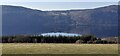
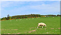

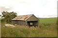
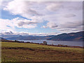

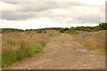
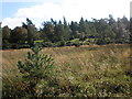
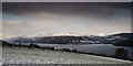
17 photos from this area
Area Information
Key information about the IV2 6TU including its size, population, and administrative classification.
- Area Type
- Postcode
- Area Size
- 10.2 km²
- Population
- Not available
- Population Density
- Not available
House Prices in IV2 6TU
18
Properties
-
Average Sold Price
-
Lowest Price
-
Highest Price
Showing 18 properties
| Address | Type | Beds | Baths | Last Sale Price | Last Sale Date | |
|---|---|---|---|---|---|---|
| Ardmor, B 862 B 852 Junction Achnabat, Dores, IV2 6TU | Bungalow | 5 | 2 | - | - | |
| Balnafoich House Historic, B 862 B 852 Junction Achnabat, Dores, IV2 6TU | undefined | - | - | - | - | |
| Caravan At Ach-na-sidhe Historic, Wester Drumashie, Essich Loch Ashie, Inverness, IV2 6TU | Mobile Home | - | - | - | - | |
| East Kindrummond Farm, B 862 B 852 Junction Achnabat, Dores, IV2 6TU | Mobile Home | - | - | - | - | |
| Athbhinn, B 862 B 852 Junction Achnabat, Dores, IV2 6TU | house | - | - | - | - | |
| The Byre, B 862 B 852 Junction Achnabat, Dores, IV2 6TU | house | - | - | - | - | |
| South Barn, B 862 B 852 Junction Achnabat, Dores, IV2 6TU | house | - | - | - | - | |
| North Barn, B 862 B 852 Junction Achnabat, Dores, IV2 6TU | house | - | - | - | - | |
| Kindrummond, B 862 B 852 Junction Achnabat, Dores, IV2 6TU | house | - | - | - | - | |
| Achnabat, B 862 B 852 Junction Achnabat, Dores, IV2 6TU | Detached | - | - | - | - |
Page 1 of 2
Energy Efficiency in IV2 6TU
Amenities
Schools
| Rank | School | Type | Entry gender | Ages |
|---|
Explore more schools in this area
Go to Schools tabDemographics
Household Size
N/A
most common
Accommodation Type
N/A
most common
Tenure
N/A
majority
Ethnic Group
N/A
most common
Religion
N/A
most common
Household Composition
N/A
most common
Age
N/A
median
N/A
most common
Household Deprivation
N/A
with no deprivation
NS-SEC
N/A
in Lower managerial occupations
Explore more demographic insights in this area
Go to Demographics tabPlanning
Planning Constraints
- Flood RiskPremium
- Ramsar Wetland SitesPremium
- Area of Outstanding Natural BeautyPremium
- Protected Nature ReservePremium
- Protected WoodlandPremium
- Crime RiskPremium