Area Overview for IV1 1SU
Photos of IV1 1SU
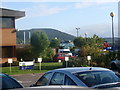
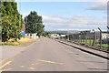
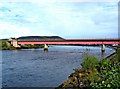
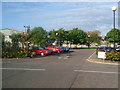
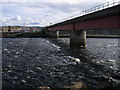
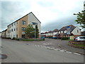
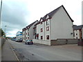
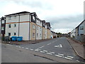
91 photos from this area
Area Information
Key information about the IV1 1SU including its size, population, and administrative classification.
- Area Type
- Postcode
- Area Size
- 57.7 hectares
- Population
- Not available
- Population Density
- Not available
House Prices in IV1 1SU
69
Properties
-
Average Sold Price
-
Lowest Price
-
Highest Price
Showing 69 properties
| Address | Type | Beds | Baths | Last Sale Price | Last Sale Date | |
|---|---|---|---|---|---|---|
| Alba Traffic Management, Longman Drive, Inverness, IV1 1SU | Office | - | - | - | - | |
| Dvsa, 38 Longman Drive, Inverness, IV1 1SU | Office | - | - | - | - | |
| Morrison Facilities Services Ltd, 38 Longman Drive, Inverness, IV1 1SU | Office | - | - | - | - | |
| Scotland Gas Network, Unit 3, 22B Longman Drive, Inverness, IV1 1SU | Office | - | - | - | - | |
| Office G5, 24 Longman Drive, Inverness, IV1 1SU | Office | - | - | - | - | |
| Aspen Business Management Ltd, Office G2, 24 Longman Drive, Inverness, IV1 1SU | Office | - | - | - | - | |
| Benchmark Animal Health, Office G1b, 24 Longman Drive, Inverness, IV1 1SU | Office | - | - | - | - | |
| Nodram, Office U2, 24 Longman Drive, Inverness, IV1 1SU | Office | - | - | - | - | |
| Continuum, Office U3a, 24 Longman Drive, Inverness, IV1 1SU | Office | - | - | - | - | |
| Unit D, 24 Longman Drive, Inverness, IV1 1SU | Industrial | - | - | - | - |
Page 1 of 7
Energy Efficiency in IV1 1SU
Amenities
Schools
| Rank | School | Type | Entry gender | Ages |
|---|
Explore more schools in this area
Go to Schools tabDemographics
Household Size
N/A
most common
Accommodation Type
N/A
most common
Tenure
N/A
majority
Ethnic Group
N/A
most common
Religion
N/A
most common
Household Composition
N/A
most common
Age
N/A
median
N/A
most common
Household Deprivation
N/A
with no deprivation
NS-SEC
N/A
in Lower managerial occupations
Explore more demographic insights in this area
Go to Demographics tabPlanning
Planning Constraints
- Flood RiskPremium
- Ramsar Wetland SitesPremium
- Area of Outstanding Natural BeautyPremium
- Protected WoodlandPremium
- Crime RiskPremium