Area Overview for IV1 1BA
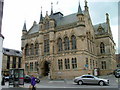
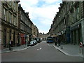
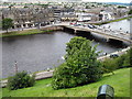
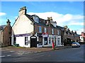
Photos of IV1 1BA


Area Information
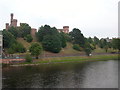
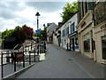
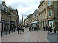
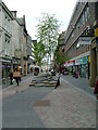
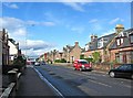
IV1 1BA is a small residential cluster in the Scottish Highlands, covering 4,514 square metres. Nestled near Inverness, this area offers a quiet, compact living environment with easy access to urban amenities. The postcode is served by Inverness Railway Station, connecting residents to regional transport networks. Nearby, Iceland Inverness, Co-op Church, and Tesco Inverness provide essential retail and grocery options, reflecting a practical, convenience-focused lifestyle. While the area’s size is modest, it is well-integrated with local infrastructure. However, flood risk is a critical concern, with 57.49% of the area falling within high-risk zones. Despite this, the absence of protected natural sites like AONB or Ramsar wetlands means development constraints are minimal. IV1 1BA appeals to those seeking a balance between seclusion and accessibility, though buyers must consider the environmental risks. The area’s character is defined by its proximity to Inverness’s services, making it a viable choice for those prioritising connectivity over expansive landscapes.
- Area Type
- Postcode
- Area Size
- 4514 m²
- Population
- Not available
- Population Density
- Not available
House Prices in IV1 1BA
Showing 2 properties
| Address | Type | Beds | Baths | Last Sale Price | Last Sale Date | |
|---|---|---|---|---|---|---|
| Greyfriars Cemetery, Friars Street, Inverness, IV1 1BA | commercial | - | - | - | - | |
| Bt Telephone Exchange, Fraser Telephone Exchange, Friars Lane, Inverness, IV1 1BA | Office | - | - | - | - |
Energy Efficiency in IV1 1BA
Living in IV1 1BA means proximity to Inverness’s retail and transport hubs. Iceland Inverness, Co-op Church, and Tesco Inverness offer a range of shopping and grocery needs, ensuring daily conveniences are within reach. The Inverness Railway Station provides direct access to regional travel, enhancing connectivity for commuters. While the area itself is small, its integration with Inverness means residents can access cultural, leisure, and professional opportunities in the city. The absence of significant green spaces or parks within the postcode suggests that outdoor activities may require travel to nearby areas. Nonetheless, the compact layout and nearby amenities create a practical, service-oriented lifestyle, ideal for those prioritising accessibility over expansive natural surroundings.
Amenities
Schools
| Rank | School | Type | Entry gender | Ages |
|---|
Explore more schools in this area
Go to Schools tabDemographics
Household Size
Accommodation Type
Tenure
Ethnic Group
Religion
Household Composition
Age
Household Deprivation
NS-SEC
Explore more demographic insights in this area
Go to Demographics tabPlanning
Planning Constraints
- Flood RiskPremium
- Ramsar Wetland SitesPremium
- Area of Outstanding Natural BeautyPremium
- Protected Nature ReservePremium
- Protected WoodlandPremium
- Crime RiskPremium