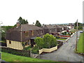
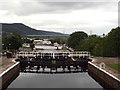
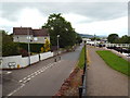
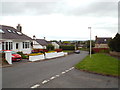
Area Overview for Inverness Central Ward
Photos of Inverness Central Ward


Area Information
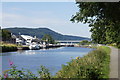
Living in Inverness Central Ward offers a direct connection to the heart of Scotland's largest city. This electoral ward sits within the Highland Council area and covers a compact urban footprint of 4.3 square kilometres. Located at the geographical coordinates of approximately 57.481177, -4.237123, the area forms Ward 14 of the city. Despite its small size, the ward holds a significant population of 12,171 people according to the 2022 census. This figure represents a slight decline from the 12,500 residents recorded in 2011. Three councillors currently represent the local community, ensuring voices from this central patch of Inverness are heard in local governance. Daily life here is defined by its location within a major city centre, yet the ward maintains distinct boundaries that shape its social fabric. Prospective buyers should note that while the area is densely populated relative to its size, the population trend has stabilised or decreased slightly over the decade. The ward is not an isolated rural village but an integral part of the wider city infrastructure. Understanding these spatial and demographic fundamentals helps you grasp the reality of being part of this specific community in the Scottish Highlands.
- Area Type
- District Borough Unitary Ward
- Area Size
- 4.3 km²
- Population
- Not available
- Population Density
- Not available
Demographics
The community profile within Inverness Central Ward reflects a general decline in resident numbers alongside shifting household dynamics. The 2022 census recorded 12,171 people dwelling in the ward, a decrease from the 12,500 individuals counted in 2011. This reduction of 329 people over eleven years suggests a tightening demographic or outflow from this specific zone. Household composition follows national Scottish trends where couples form the majority unit, comprising 32.8% of all households. Single persons account for 31.8% of households, indicating a significant portion of the population lives alone. One-parent families represent 12.6% of the total, while 10.8% of households are shared empty nesters. Ethnic diversity in the ward mirrors the national picture, with 96.1% of residents identifying as White, 2.1% as Mixed, and 1.8% as Other ethnic groups. Religion is predominantly Christian at 82.0%, while 12.2% stated they have no religion and 5.8% did not state their preference. Income data highlights deprivation risks, as 33.7% of local people worked from private households with an income below £199 per week. This statistic suggests a substantial proportion of residents navigate financial constraints, which influences their access to housing and local services. You must consider these economic realities when evaluating the suitability of homes in this area.
Household Size
Accommodation Type
Tenure
Ethnic Group
Religion
Household Composition
Age
Household Deprivation
NS-SEC
Explore more demographic insights in this area
Go to Demographics tabPlanning
Planning Constraints
- Flood RiskPremium
- Ramsar Wetland SitesPremium
- Area of Outstanding Natural BeautyPremium
- Protected WoodlandPremium
- Crime RiskPremium