Area Overview for Glasgow
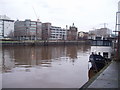
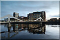
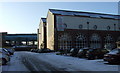
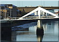
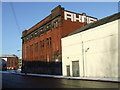
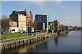
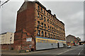
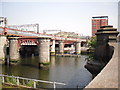
Photos of Glasgow


Area Information
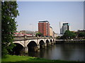
Glasgow stands as a major Scottish city covering an extensive 135.4 km². This built-up area blends Victorian and art nouveau architecture with its modern identity. The postcode G20 6RL sits on Dunard Street within the City of Glasgow local authority. This district encompasses settlements including Lambhill, Possil Park, Ruchill, and Summerston. You will find the area defined by a dynamic mix of history and contemporary urban living. The city developed through 18th-century involvement in trade and shipbuilding along the River Clyde. Residents live close to the bustling G20 postcode district which features specific residential character. The broader environment offers access to significant cultural sites like the Kelvingrove Art Gallery. Daily life here involves navigating a diverse urban landscape filled with practical amenities. You can reach famous attractions such as Glasgow Green and the city centre with relative ease. The area remains grounded in a friendly community spirit despite its status as a large metropolis. Glasgow offers a distinct character shaped by its industrial past and cultural revival.
- Area Type
- Built Up Area 250
- Area Size
- 135.4 km²
- Population
- Not available
- Population Density
- Not available
Living in Glasgow provides immediate access to a wide variety of retail, travel, and leisure amenities. You can find five notable retail outlets nearby, including Spar, Lidl Central, and Co-op Glasgow, ensuring daily shopping needs are met easily. The area boasts five metro stations that offer quick travel to various parts of the city. Five ferry terminals provide water-based transport options from locations like Broomielaw Quay and Glasgow SECC Ferry Landing. There are also five rail stations situated within the vicinity to serve different commuter routes. The Forth and Clyde Canal runs directly through the G20 postcode district, offering accessible waterways for recreation. Dunard Primary School operates within the local area, providing education for families in the immediate vicinity. You can reach Glasgow Green, a notable park, as well as major cultural attractions like the Kelvingrove Art Gallery. The city centre remains accessible from your location. The lifestyle here combines urban convenience with rich heritage, allowing you to engage with the city's famous markets and trendy cafes.
Amenities
Schools
| Rank | School | Type | Entry gender | Ages |
|---|
Explore more schools in this area
Go to Schools tabDemographics
Available data does not include specific figures regarding age profiles, household types, or home ownership levels for Glasgow. Consequently, you cannot determine the exact demographic breakdown from the current information provided. The existing records do not list statistics on the diversity of the population or the proportion of owner-occupied versus rental properties. Without these precise numbers, any attempt to describe the specific household composition would be purely speculative. The lack of detailed demographic data means the community profile remains undefined in this context. You should rely on general knowledge of Glasgow rather than specific local statistics that are absent from the source. The available information focuses on location, geography, and infrastructure rather than social composition. This gap in data prevents a detailed picture of who currently lives within the G20 area. Future reports may include these details, but they are not present now. Residents must assess the community based on the known physical and digital characteristics of the city instead.
Household Size
Accommodation Type
Tenure
Ethnic Group
Religion
Household Composition
Age
Household Deprivation
NS-SEC
Explore more demographic insights in this area
Go to Demographics tabPlanning
Planning Constraints
- Crime RiskPremium