Area Overview for G81 1NH
Photos of G81 1NH
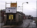
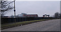
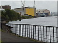
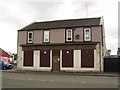
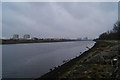
97 photos from this area
Area Information
Key information about the G81 1NH including its size, population, and administrative classification.
- Area Type
- Postcode
- Area Size
- 6.6 hectares
- Population
- Not available
- Population Density
- Not available
House Prices in G81 1NH
24
Properties
-
Average Sold Price
-
Lowest Price
-
Highest Price
Showing 24 properties
| Address | Type | Beds | Baths | Last Sale Price | Last Sale Date | |
|---|---|---|---|---|---|---|
| 582A Glasgow Road, Clydebank, G81 1NH | Office | - | - | - | - | |
| DEVELOPMENT SITE AT GLASGOW ROAD AND, MILL ROAD, Clydebank, G81 1NH | Unknown | - | - | - | - | |
| Properties At Clydeholm Terrace Edmonstone Court Hamilton Terrace Howcraigs Court, Yoker Burn Terrace, Clydebank, G81 1NH | undefined | - | - | - | - | |
| Caledonia Campervans, Workshop, 582 Glasgow Road, Clydebank, G81 1NH | Industrial | - | - | - | - | |
| Unit F, 588 Glasgow Road, Clydebank, G81 1NH | Office | - | - | - | - | |
| Sam Johnston Joiners, Unit D, 588 Glasgow Road, Clydebank, G81 1NH | Industrial | - | - | - | - | |
| 582D Glasgow Road, Clydebank, G81 1NH | Office | - | - | - | - | |
| Room 6, 582C Glasgow Road, Clydebank, G81 1NH | Office | - | - | - | - | |
| Intelligent Building, Room 5, 582C Glasgow Road, Clydebank, G81 1NH | Office | - | - | - | - | |
| Room 3, 582 Glasgow Road, Clydebank, G81 1NH | Office | - | - | - | - |
Page 1 of 3
Energy Efficiency in G81 1NH
Amenities
Schools
| Rank | School | Type | Entry gender | Ages |
|---|
Explore more schools in this area
Go to Schools tabDemographics
Household Size
N/A
most common
Accommodation Type
N/A
most common
Tenure
N/A
majority
Ethnic Group
N/A
most common
Religion
N/A
most common
Household Composition
N/A
most common
Age
N/A
median
N/A
most common
Household Deprivation
N/A
with no deprivation
NS-SEC
N/A
in Lower managerial occupations
Explore more demographic insights in this area
Go to Demographics tabPlanning
Planning Constraints
- Flood RiskPremium
- Ramsar Wetland SitesPremium
- Area of Outstanding Natural BeautyPremium
- Protected Nature ReservePremium
- Protected WoodlandPremium
- Crime & SafetyPremium