Area Overview for G52 4WH
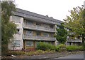
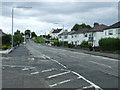
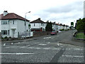
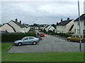
Photos of G52 4WH
Area Information
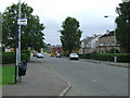
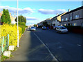
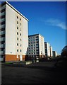
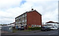
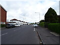
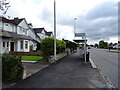
G52 4WH is a small residential postcode cluster in Scotland, positioned within a compact area that balances urban convenience with suburban tranquillity. The postcode encompasses a limited number of properties, suggesting a tightly knit community where residents are likely to know their neighbours. While specific population figures are not provided, the area’s size implies a modest footprint, typical of smaller postcode clusters. Proximity to Glasgow’s transport network is a key feature, with multiple rail, metro, and ferry services within practical reach, offering swift access to the city’s cultural and economic hubs. The area benefits from excellent digital connectivity, with fixed broadband rated at the highest possible score of 100, ensuring seamless online experiences. Mobile coverage is also strong, scoring 85, which supports reliable communication and remote work capabilities. Daily life here is likely shaped by easy access to Glasgow’s amenities, from its historic architecture to modern retail and leisure options. The area’s compact nature means residents can navigate it on foot or by bike, fostering a sense of accessibility and community cohesion.
- Area Type
- Postcode
- Area Size
- Not available
- Population
- Not available
- Population Density
- Not available
The property market in G52 4WH reflects the characteristics of a small, focused residential area. While specific home ownership percentages are not provided, the compact nature of the postcode suggests a limited number of properties, potentially concentrated in terraced or semi-detached housing. This aligns with typical patterns in smaller postcode clusters, where housing stock is often older and more uniform in style. The area’s proximity to Glasgow’s transport links may make it attractive to buyers seeking convenience without the higher costs of city-centre properties. However, the small scale of the area means that the housing stock is unlikely to be diverse, with fewer options for larger homes or modern developments. For buyers, this could imply a need to look beyond the immediate postcode for more variety, though the area’s accessibility to Glasgow’s amenities may offset this limitation.
House Prices in G52 4WH
No properties found in this postcode.
Energy Efficiency in G52 4WH
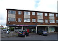
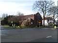
Living in G52 4WH offers access to a range of amenities within practical reach. Retail options include Farmfoods Earl Haig and Co-op stores, providing essential shopping needs. The area’s proximity to Glasgow Green, a historic park, offers recreational space for walking, picnics, or relaxation. Nearby cultural attractions, such as the Kelvingrove Art Gallery, are accessible via public transport, enriching the lifestyle for residents. Ferry services to Braehead Shopping Centre and Renfrew add convenience for leisure and retail trips. The presence of multiple rail and metro stations ensures easy access to the city’s nightlife, dining, and entertainment venues. This blend of green spaces, retail, and transport links creates a balanced lifestyle, combining suburban comfort with urban vibrancy.
Amenities
Schools
| Rank | School | Type | Entry gender | Ages |
|---|
Explore more schools in this area
Go to Schools tabDemographics
Data on the demographic profile of G52 4WH is not available in the provided information. However, the area’s character as a small residential cluster suggests a likely mix of household types, including families, professionals, and retirees, typical of suburban or semi-urban settings. Without specific statistics on age distribution, home ownership rates, or diversity metrics, it is not possible to provide a detailed breakdown of the community’s composition. The absence of deprivation data means that assumptions about quality of life, such as access to services or economic resilience, cannot be made from the available information.
Household Size
Accommodation Type
Tenure
Ethnic Group
Religion
Household Composition
Age
Household Deprivation
NS-SEC
Explore more demographic insights in this area
Go to Demographics tabPlanning
Planning Constraints
- Flood RiskPremium
- Ramsar Wetland SitesPremium
- Area of Outstanding Natural BeautyPremium
- Protected Nature ReservePremium
- Protected WoodlandPremium
- Crime & SafetyPremium