Area Overview for G52 3DT
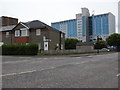
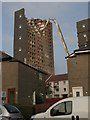
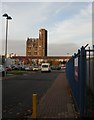
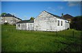
Photos of G52 3DT


Area Information
Living in G52 3DT offers a straightforward residential experience within a specific postcode cluster covering 3464 square metres in Scotland. This area sits on Dunard Street within the City of Glasgow local authority. The postcode district belongs to the broader G20 area, which encompasses settlements including Forth and Clyde Canal, Lambhill, Possil Park, Ruchill, and Summerston. Glasgow itself rests on the River Clyde and features Victorian and art nouveau architecture from its 18th-century trade history. You will find the postcode sits at coordinates 55.880282, -4.274442. The location benefits from excellent transport links and proximity to major cultural sites. Kelvingrove Art Gallery and Glasgow Green are noted as accessible attractions from the G20 area. You can access bustling markets and trendy cafes nearby. The character of the city is defined by a dynamic blend of history, art, and nightlife. For those considering homes in G52 3DT, the immediate surroundings include the Forth and Clyde Canal running through the district. Dunard Primary School operates within the local area. The region provides a direct route into the city centre while maintaining residential pockets.
- Area Type
- Postcode
- Area Size
- 3464 m²
- Population
- Not available
- Population Density
- Not available
House Prices in G52 3DT
Showing 16 properties
| Address | Type | Beds | Baths | Last Sale Price | Last Sale Date | |
|---|---|---|---|---|---|---|
| 66 Tannadice Avenue, Glasgow, G52 3DT | Flat | - | - | - | - | |
| 44 Tannadice Avenue, Glasgow, G52 3DT | Flat | 2 | - | - | - | |
| 54 Tannadice Avenue, Glasgow, G52 3DT | Flat | - | - | - | - | |
| 72 Tannadice Avenue, Glasgow, G52 3DT | Flat | - | - | - | - | |
| 64 Tannadice Avenue, Glasgow, G52 3DT | Flat | 2 | - | - | - | |
| 74 Tannadice Avenue, Glasgow, G52 3DT | Flat | - | - | - | - | |
| 42 Tannadice Avenue, Glasgow, G52 3DT | Flat | 3 | 1 | - | - | |
| 46 Tannadice Avenue, Glasgow, G52 3DT | Flat | - | - | - | - | |
| 70 Tannadice Avenue, Glasgow, G52 3DT | Flat | - | - | - | - | |
| 52 Tannadice Avenue, Glasgow, G52 3DT | Flat | - | - | - | - |
Energy Efficiency in G52 3DT
Amenities
Schools
| Rank | School | Type | Entry gender | Ages |
|---|
Explore more schools in this area
Go to Schools tabDemographics
Demographic data for this specific location is not provided in the available records. The broader G20 postcode district contains several settlements including Forth and Clyde Canal, Lambhill, Possil Park, Ruchill, and Summerston. Without specific census figures for G52 3DT, precise details on population age, household types, and deprivation levels remain unavailable for this exact cluster. You cannot determine the percentage of owner-occupiers or renters without explicit data points linked to this postcode. The area sits within the City of Glasgow local authority in the ceremonial county of Lanarkshire. You must rely on broader Glasgow statistics for general community insights. The postcode covers a small residential space of 3464 square metres. Specific information regarding school catchment zones or typical family structures is absent from the current dataset. Municipal boundaries and local authority records confirm the location exists within Glasgow City. Future research may expand on these missing demographics, but current data does not support detailed demographic profiling for G52 3DT alone.
Household Size
Accommodation Type
Tenure
Ethnic Group
Religion
Household Composition
Age
Household Deprivation
NS-SEC
Explore more demographic insights in this area
Go to Demographics tabPlanning
Planning Constraints
- Flood RiskPremium
- Ramsar Wetland SitesPremium
- Area of Outstanding Natural BeautyPremium
- Protected Nature ReservePremium
- Protected WoodlandPremium
- Crime & SafetyPremium