Area Overview for G51 1AW
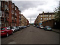
Photos of G51 1AW


Area Information
Living in G51 1AW means being part of a compact, residential postcode area in Scotland, covering 3,722 square metres. This small cluster is positioned for convenience, with proximity to multiple transport hubs and retail centres. The area benefits from excellent digital connectivity, with a broadband score of 100 — the highest possible — ensuring seamless online access for work, education, or leisure. Mobile coverage scores 85, which is strong for reliable communication. Residents are within easy reach of Glasgow International Airport, offering direct links to national and international destinations. The area’s strategic location connects it to Glasgow’s broader network of amenities, from historic sites to modern conveniences. While specific community details are not provided, the area’s infrastructure suggests it caters to a mix of commuters and those seeking accessibility to urban services. The absence of environmental constraints like flood risk or protected natural areas indicates a practical, low-maintenance living environment. For those prioritising connectivity and proximity to transport, G51 1AW offers a compact, well-served base within Scotland’s largest city.
- Area Type
- Postcode
- Area Size
- 3722 m²
- Population
- Not available
- Population Density
- Not available
The property market in G51 1AW is shaped by its small size and limited data availability. While specific home ownership percentages or accommodation types are not provided, the area’s compact nature suggests a modest number of properties, possibly concentrated in terraced or semi-detached housing typical of urban Scotland. The absence of protected natural areas or planning constraints may support a stable market with fewer restrictions on development. However, without figures on rental versus owner-occupied homes, it is unclear whether the area leans toward a rental market or long-term residency. Buyers should consider the area’s proximity to transport hubs and retail centres as key advantages, though the small footprint means competition for properties may be limited. Those seeking a straightforward, low-risk investment in a well-connected postcode may find G51 1AW appealing, but further local insights would be necessary to assess its broader market dynamics.
House Prices in G51 1AW
Showing 36 properties
| Address | Type | Beds | Baths | Last Sale Price | Last Sale Date | |
|---|---|---|---|---|---|---|
| Flat 1/1, 75 Middleton Street, Glasgow, G51 1AW | Flat | - | - | - | - | |
| Flat 0/2, 75 Middleton Street, Glasgow, G51 1AW | Flat | - | - | - | - | |
| Flat 2/2, 75 Middleton Street, Glasgow, G51 1AW | Flat | - | - | - | - | |
| Flat 2/1, 75 Middleton Street, Glasgow, G51 1AW | Flat | - | - | - | - | |
| Flat 1/2, 75 Middleton Street, Glasgow, G51 1AW | Flat | - | - | - | - | |
| Flat 0/1, 75 Middleton Street, Glasgow, G51 1AW | Flat | - | - | - | - | |
| Flat 0/2, 33 Middleton Street, Glasgow, G51 1AW | Flat | - | - | - | - | |
| Flat 1/1, 33 Middleton Street, Glasgow, G51 1AW | Flat | - | - | - | - | |
| Flat 0/2, 59 Middleton Street, Glasgow, G51 1AW | Flat | - | - | - | - | |
| Flat 1/1, 51 Middleton Street, Glasgow, G51 1AW | Flat | - | - | - | - |
Energy Efficiency in G51 1AW
Residents of G51 1AW have access to a range of amenities within practical reach. The area is near five retail outlets, including Co-op Ibrox and Morrisons Daily Glasgow, offering everyday shopping needs. For leisure, ferry services at Glasgow Science Centre North Quay and Plantation Quay provide water-based travel options, while nearby parks and cultural attractions are accessible through Glasgow’s broader network. The Forth and Clyde Canal runs through the broader postcode district, though specific local parks or recreational spaces are not named for G51 1AW itself. The presence of multiple metro and rail stations, such as Kinning Park and Exhibition Centre, ensures easy access to Glasgow’s vibrant city centre, where attractions like Kelvingrove Art Gallery and Glasgow Green are located. While the area’s immediate surroundings lack detailed listings of cafes or dining spots, its transport links mean residents can quickly reach urban hubs for dining, entertainment, and cultural experiences. The mix of retail, transport, and connectivity options supports a lifestyle that balances convenience with access to larger city amenities.
Amenities
Schools
| Rank | School | Type | Entry gender | Ages |
|---|
Explore more schools in this area
Go to Schools tabDemographics
The demographics of G51 1AW are not explicitly detailed in the data, so this section cannot provide specific figures on age profiles, household types, or diversity. However, the absence of deprivation data or socioeconomic breakdowns means no claims can be made about community composition or quality of life factors tied to those metrics. The area’s small size — 3,722 square metres — suggests a limited population, likely concentrated in a few residential clusters. Without data on home ownership rates or accommodation types, it is not possible to describe the housing stock or the proportion of owner-occupied versus rental properties. The focus here is on what is known: the area is free from planning constraints like protected woodlands or areas of outstanding natural beauty, which may influence development and living conditions. Residents are likely to benefit from the area’s proximity to transport and amenities, though no specific data on community characteristics or diversity is available.
Household Size
Accommodation Type
Tenure
Ethnic Group
Religion
Household Composition
Age
Household Deprivation
NS-SEC
Explore more demographic insights in this area
Go to Demographics tabPlanning
Planning Constraints
- Flood RiskPremium
- Ramsar Wetland SitesPremium
- Area of Outstanding Natural BeautyPremium
- Protected Nature ReservePremium
- Protected WoodlandPremium
- Crime & SafetyPremium