Area Overview for G5 9RU
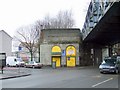
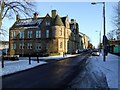
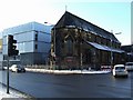
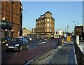
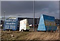
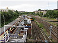
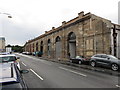
Photos of G5 9RU

Area Information
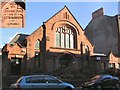
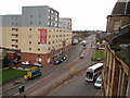
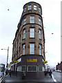
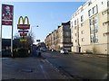
The G5 9RU postcode occupies a specific residential cluster in Glasgow, covering an area of 5,875 square metres. This small footprint defines a tightly knit pocket within the G20 district, which encompasses settlements such as Lambhill, Possil Park, and Ruchill. You are looking at a residential street situated on Dunard Street, located within the City of Glasgow local authority. The broader Glasgow landscape features Victorian and art nouveau architecture developed during the 18th century. These historical influences shape the streetscape you will encounter if you choose to live in G5 9RU. The area is part of a city known for its rich cultural heritage and friendly community spirit. Nearby landmarks include Glasgow Green, the Kelvingrove Art Gallery, and the Forth and Clyde Canal. While the postcode is small, it sits within a network that offers excellent transport links. The surrounding environment delivers a dynamic blend of history, art, and nightlife. Familiarising yourself with this small residential cluster provides clear context for your decision to buy homes in G5 9RU.
- Area Type
- Postcode
- Area Size
- 5875 m²
- Population
- Not available
- Population Density
- Not available
Specific statistics regarding the property market in G5 9RU are not provided in the current dataset. You will not find information on home ownership percentages, the types of housing stock, or rental market dynamics for this postcode. The data describes the area as a small residential cluster covering 5,875 square metres, located in the G20 district. While the broader G20 area includes settlements like Ruchill and Possil Park, no graphic details regarding property values or tenancy rates exist for G5 9RU specifically. You cannot determine whether this area is primarily owner-occupied or dominated by private renters based on the available information. The data does not specify if the homes are terraced, semi-detached, or flats. Consequently, you must look beyond this specific postcode to understand the wider housing landscape of the City of Glasgow. No data on market trends or sale prices is included in the records for this immediate neighbourhood.
House Prices in G5 9RU
Showing 20 properties
| Address | Type | Beds | Baths | Last Sale Price | Last Sale Date | |
|---|---|---|---|---|---|---|
| Flat 1/1, 473 Eglinton Street, Glasgow, G5 9RU | Flat | - | - | - | - | |
| Flat 1/1, 465 Eglinton Street, Glasgow, G5 9RU | Flat | - | - | - | - | |
| Flat 1/1, 445 Eglinton Street, Glasgow, G5 9RU | Flat | - | - | - | - | |
| 477 Eglinton Street, Glasgow, G5 9RU | shop | - | - | - | - | |
| 479 Eglinton Street, Glasgow, G5 9RU | shop | - | - | - | - | |
| 463 Eglinton Street, Glasgow, G5 9RU | shop | - | - | - | - | |
| 457 Eglinton Street, Glasgow, G5 9RU | Industrial | - | - | - | - | |
| Flat 1/2, 455 Eglinton Street, Glasgow, G5 9RU | Flat | - | - | - | - | |
| 449 Eglinton Street, Glasgow, G5 9RU | shop | - | - | - | - | |
| Flat 1/1, 455 Eglinton Street, Glasgow, G5 9RU | Flat | - | - | - | - |
Energy Efficiency in G5 9RU
Living in G5 9RU places you within easy reach of numerous transport hubs and supermarkets. You have direct access to five railway stations, including Pollokshields East, Queens Park, and Pollokshields West Railway Station. Five underground stations are also practical options, such as West Street and Bridge Street Underground Station. The area features five ferry terminals, offering connections from Glasgow Central Station Bridge Ferry Landing and Broomielaw Quay. For daily shopping needs, three major supermarkets are located nearby. You can visit Lidl Govanhill, Iceland Crown St, or Aldi Crown. These amenities are within practical reach of your doorstep. The combination of rail, metro, and ferry links provides flexible options for getting across the city for work or leisure. The proximity to multiple grocery stores simplifies your weekly routine. This density of transport and retail options creates a convenient lifestyle without requiring a long commute or significant travel time.
Amenities
Schools
| Rank | School | Type | Entry gender | Ages |
|---|
Explore more schools in this area
Go to Schools tabDemographics
Community data for the G5 9RU postcode area is not included in the current records. You will not find specific figures regarding the age profile, household types, or home ownership levels for this specific postcode. Similarly, no information is available on the diversity or deprivation metrics for this cluster. The only factual demographic identifier provided is the geographical location on Dunard Street within the G20 district. Because no statistics on population density or socioeconomic status are listed, you cannot draw conclusions about who lives here or the character of the local families. The data presents a gap in this specific category. Without access to census figures or demographic surveys for this suffix, any attempt to describe the community composition would be speculative. You must rely on the physical location and surrounding context rather than statistical profiles when considering demographics for this specific postcode. The absence of recorded data means you cannot assess the mix of ages or household structures present in this small residential zone.
Household Size
Accommodation Type
Tenure
Ethnic Group
Religion
Household Composition
Age
Household Deprivation
NS-SEC
Explore more demographic insights in this area
Go to Demographics tabPlanning
Planning Constraints
- Flood RiskPremium
- Ramsar Wetland SitesPremium
- Area of Outstanding Natural BeautyPremium
- Protected Nature ReservePremium
- Protected WoodlandPremium
- Crime RiskPremium