Area Overview for G5 9LA
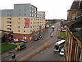
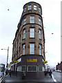
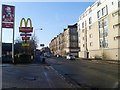
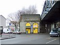
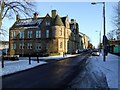
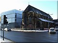
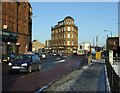
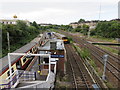
Photos of G5 9LA


Area Information
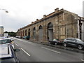
G5 9LA is a small residential postcode cluster nestled within Glasgow, Scotland, offering a compact yet connected living experience. Situated in the City of Glasgow local authority, it lies within the broader G20 postcode district, which includes areas like Forth and Clyde Canal, Lambhill, and Summerston. The area spans 2,469 square metres, blending urban convenience with Glasgow’s historic character. Residents benefit from proximity to the River Clyde, which has shaped the city’s architectural legacy, including Victorian and art nouveau buildings. Daily life here is defined by accessible transport, with multiple underground stations, rail links, and ferry terminals within reach. The area’s mix of retail, leisure, and cultural amenities ensures a vibrant lifestyle, while its compact size fosters a sense of community. For those seeking a balance between city energy and manageable living space, G5 9LA presents a distinct option within Glasgow’s dynamic landscape.
- Area Type
- Postcode
- Area Size
- 2469 m²
- Population
- Not available
- Population Density
- Not available
The property market in G5 9LA is shaped by its small size and integration into Glasgow’s broader housing stock. While specific home ownership percentages are not listed, the area likely mirrors Glasgow’s mix of owner-occupied and rental properties. The presence of nearby schools, such as Dunard Primary, and proximity to transport hubs may attract both first-time buyers and investors. Given the postcode’s compact nature, properties here are likely to be mid-sized homes or flats, reflecting Glasgow’s varied accommodation types. Buyers should consider the area’s limited size, which means the immediate surroundings play a significant role in determining lifestyle options.
House Prices in G5 9LA
Showing 10 properties
| Address | Type | Beds | Baths | Last Sale Price | Last Sale Date | |
|---|---|---|---|---|---|---|
| 40 Cavendish Court, Glasgow, G5 9LA | Semi-detached | 3 | - | - | - | |
| 20 Cavendish Court, Glasgow, G5 9LA | Terraced | - | - | - | - | |
| 36 Cavendish Court, Glasgow, G5 9LA | house | - | - | - | - | |
| 12 Cavendish Court, Glasgow, G5 9LA | Bungalow | - | - | - | - | |
| 24 Cavendish Court, Glasgow, G5 9LA | house | - | - | - | - | |
| 44 Cavendish Court, Glasgow, G5 9LA | house | - | - | - | - | |
| 28 Cavendish Court, Glasgow, G5 9LA | Terraced | - | - | - | - | |
| 48 Cavendish Court, Glasgow, G5 9LA | Semi-detached | - | - | - | - | |
| 16 Cavendish Court, Glasgow, G5 9LA | Bungalow | - | - | - | - | |
| 32 Cavendish Court, Glasgow, G5 9LA | Terraced | - | - | - | - |
Energy Efficiency in G5 9LA
Living in G5 9LA grants access to a range of amenities within practical reach. Retail options include Co-op Glasgow, Aldi Crown, and Iceland Crown St, offering everyday shopping convenience. The area’s proximity to Glasgow Green provides a green space for relaxation, while the Forth and Clyde Canal adds a scenic element to daily life. Cultural attractions like the Kelvingrove Art Gallery are accessible via the city’s transport network. The mix of underground stations, rail links, and ferry terminals ensures easy movement, while nearby markets, cafes, and parks contribute to a lively, community-oriented lifestyle.
Amenities
Schools
| Rank | School | Type | Entry gender | Ages |
|---|
Explore more schools in this area
Go to Schools tabDemographics
The demographics of G5 9LA are not explicitly detailed in the available data. However, the broader G20 postcode district is part of Glasgow, a city known for its diverse population and mix of household types. While specific figures on age profiles, home ownership rates, or deprivation levels are absent, Glasgow as a whole reflects a range of socio-economic backgrounds. The area’s proximity to amenities like Dunard Primary School and Glasgow Green suggests a family-friendly environment, though exact data on household composition or diversity remains unprovided.
Household Size
Accommodation Type
Tenure
Ethnic Group
Religion
Household Composition
Age
Household Deprivation
NS-SEC
Explore more demographic insights in this area
Go to Demographics tabPlanning
Planning Constraints
- Flood RiskPremium
- Ramsar Wetland SitesPremium
- Area of Outstanding Natural BeautyPremium
- Protected Nature ReservePremium
- Protected WoodlandPremium
- Crime RiskPremium