Area Overview for G5 8DL
Photos of G5 8DL


Area Information
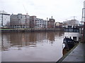
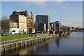
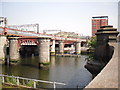
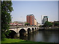
Living in G5 8DL means residing in a compact residential cluster in Scotland’s City of Glasgow, covering just 2,402 square metres. This small postcode area is part of the broader Glasgow postcode district, which includes settlements like Forth and Clyde Canal, Lambhill, and Ruchill. The area benefits from proximity to key transport hubs, including five metro stations such as Bridge Street and St Enoch Underground Station, as well as rail links like Glasgow Central Low Level Railway Station. Daily life here is shaped by easy access to retail, with Spar, Co-op Glasgow, and Lidl Central within walking distance. The area’s strategic location near the River Clyde and historic architecture reflects Glasgow’s legacy as a hub of trade and industry. Residents enjoy a mix of modern convenience and traditional charm, with parks like Glasgow Green nearby. While the area is small, its connectivity to cultural landmarks like the Kelvingrove Art Gallery and leisure opportunities such as the Forth and Clyde Canal adds to its appeal for those seeking a blend of urban and recreational living.
- Area Type
- Postcode
- Area Size
- 2402 m²
- Population
- Not available
- Population Density
- Not available
House Prices in G5 8DL
Showing 8 properties
| Address | Type | Beds | Baths | Last Sale Price | Last Sale Date | |
|---|---|---|---|---|---|---|
| 119 Commerce Street, Glasgow, G5 8DL | storage_distribution | - | - | - | - | |
| 111 Commerce Street, Glasgow, G5 8DL | shop | - | - | - | - | |
| 121 Commerce Street, Glasgow, G5 8DL | shop | - | - | - | - | |
| 105 Commerce Street, Glasgow, G5 8DL | warehouse | - | - | - | - | |
| 123 Commerce Street, Glasgow, G5 8DL | shop | - | - | - | - | |
| 125 Commerce Street, Glasgow, G5 8DL | storage_distribution | - | - | - | - | |
| 117 Commerce Street, Glasgow, G5 8DL | warehouse | - | - | - | - | |
| 107 Commerce Street, Glasgow, G5 8DL | retail_financial | - | - | - | - |
Energy Efficiency in G5 8DL
G5 8DL’s residents have access to a range of amenities within walking or short transit distance. Retail options include Spar, Co-op Glasgow, and Lidl Central, offering everyday shopping needs. The area’s proximity to Glasgow Green provides a green space for relaxation and outdoor activities, while the Forth and Clyde Canal adds a scenic element to the local landscape. Cultural attractions like the Kelvingrove Art Gallery are accessible via nearby transport links, enriching the area’s lifestyle. The presence of multiple ferry terminals and rail stations ensures easy access to the city’s broader offerings, from markets to nightlife. Dunard Primary School, located in the vicinity, supports families with educational needs. The combination of retail, green spaces, and transport links creates a convenient, dynamic lifestyle that balances urban living with recreational opportunities.
Amenities
Schools
| Rank | School | Type | Entry gender | Ages |
|---|
Explore more schools in this area
Go to Schools tabDemographics
Household Size
Accommodation Type
Tenure
Ethnic Group
Religion
Household Composition
Age
Household Deprivation
NS-SEC
Explore more demographic insights in this area
Go to Demographics tabPlanning
Planning Constraints
- Flood RiskPremium
- Ramsar Wetland SitesPremium
- Area of Outstanding Natural BeautyPremium
- Protected Nature ReservePremium
- Protected WoodlandPremium
- Crime & SafetyPremium