Area Overview for G5 0RQ
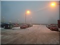
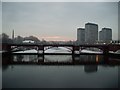
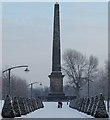
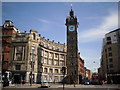
Photos of G5 0RQ


Area Information
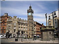
G5 0RQ is a small residential postcode nestled in Glasgow, Scotland, covering 6,764 square metres. This area benefits from a strategic location near key transport hubs, including multiple underground stations, railway lines, and ferry terminals, making it highly accessible for commuters. Glasgow’s historic influence as a trade and shipbuilding centre is evident in its architecture, though G5 0RQ itself is a more modern residential cluster. The area is surrounded by practical amenities, such as Co-op Glasgow, Aldi Crown, and Iceland Crown St, ensuring daily needs are met. However, flood risk is a notable concern, with a score of 55.15 indicating a critical level of vulnerability. Despite this, the area’s connectivity and proximity to cultural landmarks like the Kelvingrove Art Gallery and Glasgow Green offer a blend of convenience and urban vibrancy. Residents here likely enjoy a mix of local community life and easy access to Glasgow’s broader attractions, though flood preparedness would be a key consideration for prospective buyers.
- Area Type
- Postcode
- Area Size
- 6764 m²
- Population
- Not available
- Population Density
- Not available
The property market in G5 0RQ is shaped by its small size and proximity to transport infrastructure. While specific ownership percentages are not provided, the area’s mix of retail, rail, and ferry access suggests a balance between owner-occupied homes and rental properties. Given Glasgow’s urban character, it is likely that the housing stock includes a range of flats and terraced homes, typical of the city’s post-industrial residential areas. Buyers should consider the flood risk, which could impact property value and insurance costs. The area’s compact size means that immediate surroundings may offer similar housing options, but the critical flood rating would require thorough due diligence. For those prioritising connectivity, the proximity to multiple transport links may outweigh environmental concerns, though buyers should weigh these factors carefully.
House Prices in G5 0RQ
Showing 45 properties
| Address | Type | Beds | Baths | Last Sale Price | Last Sale Date | |
|---|---|---|---|---|---|---|
| 156 Ballater Place, Glasgow, G5 0RQ | Flat | - | - | - | - | |
| Flat 2/1, 124 Ballater Place, Glasgow, G5 0RQ | Flat | - | - | - | - | |
| 146 Ballater Place, Glasgow, G5 0RQ | Flat | - | - | - | - | |
| Flat 1/1, 134 Ballater Place, Glasgow, G5 0RQ | Flat | - | - | - | - | |
| Flat 1/2, 134 Ballater Place, Glasgow, G5 0RQ | Flat | - | - | - | - | |
| Flat 2/4, 134 Ballater Place, Glasgow, G5 0RQ | Flat | - | - | - | - | |
| 136 Ballater Place, Glasgow, G5 0RQ | Flat | - | - | - | - | |
| Flat 2/3, 124 Ballater Place, Glasgow, G5 0RQ | Flat | - | - | - | - | |
| Flat 1/2, 144 Ballater Place, Glasgow, G5 0RQ | Flat | - | - | - | - | |
| 140 Ballater Place, Glasgow, G5 0RQ | Flat | - | - | - | - |
Energy Efficiency in G5 0RQ
Living in G5 0RQ offers access to a range of amenities within walking or short transit distance. Retail options include Co-op Glasgow, Aldi Crown, and Iceland Crown St, catering to everyday shopping needs. The area’s transport links connect residents to Glasgow’s cultural and recreational hubs, such as Glasgow Green, a historic park ideal for leisurely strolls or picnics. Nearby, the Forth and Clyde Canal adds a scenic element to the local environment. Dunard Primary School is a notable local institution, serving families in the area. The proximity to the Kelvingrove Art Gallery and the city’s vibrant markets and cafes further enriches the lifestyle, blending urban convenience with Glasgow’s heritage. This mix of practicality and cultural access makes G5 0RQ appealing to those seeking a balanced, connected lifestyle.
Amenities
Schools
| Rank | School | Type | Entry gender | Ages |
|---|
Explore more schools in this area
Go to Schools tabDemographics
This section cannot be completed as no demographic data—such as age profile, household types, home ownership levels, or diversity statistics—is provided in the available information.
Household Size
Accommodation Type
Tenure
Ethnic Group
Religion
Household Composition
Age
Household Deprivation
NS-SEC
Explore more demographic insights in this area
Go to Demographics tabPlanning
Planning Constraints
- Flood RiskPremium
- Ramsar Wetland SitesPremium
- Area of Outstanding Natural BeautyPremium
- Protected Nature ReservePremium
- Protected WoodlandPremium
- Crime RiskPremium