Area Overview for G46 8TA
Photos of G46 8TA


Area Information
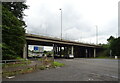
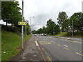
G46 8TA is a compact residential postcode in Scotland, covering just 1.6 hectares. Situated in a small cluster of homes, it offers a quiet, focused living environment with easy access to Glasgow’s broader urban network. The area’s proximity to major transport routes and cultural hubs makes it appealing for those seeking a blend of convenience and tranquillity. Glasgow itself, with its historic architecture and vibrant cultural scene, lies just beyond the postcode’s boundaries, offering residents access to world-class attractions like the Kelvingrove Art Gallery and Glasgow Green. The area’s small size means it is likely to have a tight-knit community feel, though specific details about its population or demographics are not included in the data. For those prioritising connectivity, the postcode benefits from excellent rail and metro links, with multiple stations within practical reach. This makes it a viable choice for commuters or those who value easy access to public transport. The area’s low flood risk and absence of major environmental constraints further enhance its appeal as a stable, secure place to live.
- Area Type
- Postcode
- Area Size
- 1.6 hectares
- Population
- Not available
- Population Density
- Not available
House Prices in G46 8TA
Showing 28 properties
| Address | Type | Beds | Baths | Last Sale Price | Last Sale Date | |
|---|---|---|---|---|---|---|
| 48 Inverewe Avenue, Glasgow, G46 8TA | Detached | 4 | 1 | - | - | |
| 28 Inverewe Avenue, Glasgow, G46 8TA | Flat | 2 | 1 | - | - | |
| 8 Inverewe Avenue, Glasgow, G46 8TA | Semi-detached | - | - | - | - | |
| 20 Inverewe Avenue, Glasgow, G46 8TA | Flat | 2 | - | - | - | |
| 52 Inverewe Avenue, Glasgow, G46 8TA | house | 3 | - | - | - | |
| 36 Inverewe Avenue, Glasgow, G46 8TA | Semi-detached | - | - | - | - | |
| 46 Inverewe Avenue, Glasgow, G46 8TA | Semi-detached | - | - | - | - | |
| 32 Inverewe Avenue, Glasgow, G46 8TA | Flat | - | - | - | - | |
| 34 Inverewe Avenue, Glasgow, G46 8TA | Flat | - | - | - | - | |
| 4 Inverewe Avenue, Glasgow, G46 8TA | house | - | - | - | - |
Energy Efficiency in G46 8TA
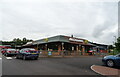
Living in G46 8TA grants access to a range of amenities within practical reach. Retail options include Co-op EGMF Darnley, Sainsburys Darnley, and Farmfoods Giffnock, offering everyday shopping convenience. For dining and leisure, the area’s proximity to Glasgow’s cultural landmarks means residents can enjoy the Kelvingrove Art Gallery, Glasgow Green, and the Forth and Clyde Canal. The nearby Dunard Primary School provides a local educational resource, while the city’s historic architecture and vibrant markets add to the area’s character. The presence of multiple transport hubs also enhances accessibility to larger retail centres, entertainment venues, and green spaces. The mix of retail, education, and recreational facilities creates a balanced lifestyle, blending local convenience with the opportunities of a major city.
Amenities
Schools
| Rank | School | Type | Entry gender | Ages |
|---|
Explore more schools in this area
Go to Schools tabDemographics
Household Size
Accommodation Type
Tenure
Ethnic Group
Religion
Household Composition
Age
Household Deprivation
NS-SEC
Explore more demographic insights in this area
Go to Demographics tabPlanning
Planning Constraints
- Flood RiskPremium
- Ramsar Wetland SitesPremium
- Area of Outstanding Natural BeautyPremium
- Protected Nature ReservePremium
- Protected WoodlandPremium
- Crime RiskPremium