Area Overview for G46 8QG
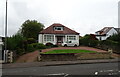
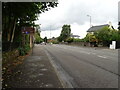
Photos of G46 8QG


Area Information
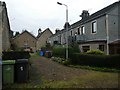
G46 8QG is a small residential postcode area in Scotland, covering just 2.0 hectares. It is part of a compact cluster of homes, likely serving a modest number of residents. Situated in a region with strong historical and cultural ties to Glasgow, this area benefits from proximity to major urban amenities, including transport hubs and retail centres. The postcode’s size suggests a low-density, possibly semi-rural or suburban character, though its exact location within Scotland is not specified. Given its small footprint, G46 8QG may cater to a niche community, potentially including commuters or those seeking a quieter alternative to larger cities. The area’s digital connectivity is robust, with a broadband score of 100, ensuring seamless internet access for residents. While no specific landmarks or schools are listed for this postcode, its proximity to Glasgow’s infrastructure—such as rail networks and airports—positions it as a strategic location for those balancing urban convenience with a more secluded living environment.
- Area Type
- Postcode
- Area Size
- 2.0 hectares
- Population
- Not available
- Population Density
- Not available
House Prices in G46 8QG
Showing 6 properties
| Address | Type | Beds | Baths | Last Sale Price | Last Sale Date | |
|---|---|---|---|---|---|---|
| 1551 Nitshill Road, Glasgow, G46 8QG | Semi-detached | - | - | - | - | |
| 1549 Nitshill Road, Glasgow, G46 8QG | Semi-detached | - | - | - | - | |
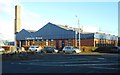
| Block 2 Units 1-4, 1501 Nitshill Road, Glasgow, G46 8QG | shop | - | - | - | - | |
| Block 1 Unit 5, 1501 Nitshill Road, Glasgow, G46 8QG | retail_financial | - | - | - | - | |
| Block 3 Unit 6, 1501 Nitshill Road, Glasgow, G46 8QG | storage_distribution | - | - | - | - | |
| Block 1 Unit 1, 1501 Nitshill Road, Glasgow, G46 8QG | retail_financial | - | - | - | - |
Energy Efficiency in G46 8QG
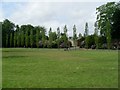
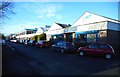
Living in G46 8QG offers access to a range of amenities within reach. Retail options include Co-op EGMF Darnley, Farmfoods Giffnock, and Spar, providing everyday shopping convenience. The area’s proximity to rail and metro stations ensures easy access to Glasgow’s cultural and commercial centres, including the Kelvingrove Art Gallery and Glasgow Green. Ferries at Plantation Quay and Glasgow SECC Ferry Landing connect residents to waterfront activities and events. While no specific parks or leisure facilities are listed for the postcode itself, its location near Glasgow’s urban core likely means access to broader recreational opportunities. The presence of multiple transport options and retail outlets suggests a lifestyle that balances local convenience with urban connectivity, making it appealing to those who value accessibility without sacrificing a sense of community.
Amenities
Schools
| Rank | School | Type | Entry gender | Ages |
|---|
Explore more schools in this area
Go to Schools tabDemographics
Household Size
Accommodation Type
Tenure
Ethnic Group
Religion
Household Composition
Age
Household Deprivation
NS-SEC
Explore more demographic insights in this area
Go to Demographics tabPlanning
Planning Constraints
- Flood RiskPremium
- Ramsar Wetland SitesPremium
- Area of Outstanding Natural BeautyPremium
- Protected Nature ReservePremium
- Protected WoodlandPremium
- Crime RiskPremium