Area Overview for G46 8HU
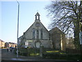
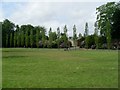
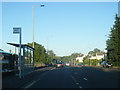
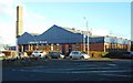
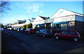
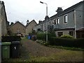
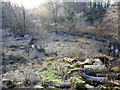
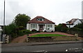
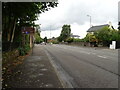
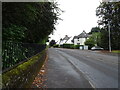
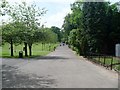
Photos of G46 8HU

Area Information
G46 8HU is a specific postcode area covering a small residential cluster in Scotland. The local land measure is 1.3 hectares, which means you are in a concentrated neighbourhood rather than a sprawling suburb. This compact size often creates a tight-knit environment where locals know one another. While the broader G20 postcode district encompasses settlements like Lambhill, Possil Park, and Ruchill, G46 8HU maintains its own distinct identity within Glasgow. The area sits within the City of Glasgow local authority in the ceremonial county of Lanarkshire. You can find this postcode at coordinates 55.880282, -4.274442. The surrounding city benefits from Victorian and art nouveau architecture stemming from Glasgow's 18th-century involvement in trade and shipbuilding. Living in G46 8HU offers access to this rich cultural heritage while enjoying the practical benefits of a defined, small-scale living space. The area is situated on Dunard Street, giving it a clear geographical anchor within the wider city fabric.
- Area Type
- Postcode
- Area Size
- 1.3 hectares
- Population
- Not available
- Population Density
- Not available
Detailed property market statistics for G46 8HU are not included in the provided dataset. You cannot determine the home ownership percentage or the specific mix of terraced, semi-detached, or detached homes for this exact location. The only structural information available is that this postcode covers 1.3 hectares as a small residential cluster. While the broader G20 district includes areas like Ruchill and Summerston, specific data on rental versus owner-occupier splits for G46 8HU is absent. You do not have figures to know if the market is primarily for first-time buyers, families, or investors. There is no data on average house prices or rental yields to help you budget for homes in this area. Consequently, you must rely on the general context of Glasgow's housing market rather than specific numbers for this postcode. The lack of accommodation type data means you cannot confirm the prevalence of modern apartments versus traditional Victorian homes without further research.
House Prices in G46 8HU
Showing 53 properties
| Address | Type | Beds | Baths | Last Sale Price | Last Sale Date | |
|---|---|---|---|---|---|---|
| 43 Loganswell Gardens, Glasgow, G46 8HU | Flat | 1 | 1 | - | - | |
| 48 Loganswell Gardens, Glasgow, G46 8HU | Flat | 2 | 1 | - | - | |
| 5 Loganswell Gardens, Glasgow, G46 8HU | Flat | 1 | 1 | - | - | |
| 14 Loganswell Gardens, Glasgow, G46 8HU | Semi-detached | 1 | 1 | - | - | |
| 9 Loganswell Gardens, Glasgow, G46 8HU | Detached | 3 | 1 | - | - | |
| 35 Loganswell Gardens, Glasgow, G46 8HU | Flat | 1 | 1 | - | - | |
| 74 Loganswell Gardens, Glasgow, G46 8HU | Flat | 2 | 1 | - | - | |
| 8 Loganswell Gardens, Glasgow, G46 8HU | Detached | 3 | - | - | - | |
| 3 Loganswell Gardens, Glasgow, G46 8HU | Bungalow | 3 | - | - | - | |
| 17 Loganswell Gardens, Glasgow, G46 8HU | Semi-detached | 2 | 1 | - | - |
Energy Efficiency in G46 8HU
Residents of G46 8HU have five retail amenities within practical reach. You can shop at Co-op EGMF Darnley, Farmfoods Giffnock, and Spar for your daily groceries and essentials. For leisure and culture, five rail stations serve the area, providing easy access to London Street Railway Station and other hubs. You can also reach five metro stations, including Cessnock Underground Station and Whitecraigs Railway Station, for deeper journeys into Glasgow. Transport by water is an option via five ferry locations, such as Glasgow Science Centre North Quay and Glasgow SECC Ferry Landing. Five air travel points are listed, including Glasgow International Airport, though this refers to nearby global connectivity rather than local ferries. Notable local features mentioned for the broader G20 area include Dunard Primary School and the Forth and Clyde Canal, which runs through the district. While G46 8HU is a small 1.3-hectare cluster, its proximity to these stations and shops ensures you do not need to travel far for most daily needs.
Amenities
Schools
| Rank | School | Type | Entry gender | Ages |
|---|
Explore more schools in this area
Go to Schools tabDemographics
The data available for G46 8HU does not include detailed breakdowns of age profiles, household types, or diversity statistics. Without specific figures on population composition, it is not possible to describe the community's demographic makeup with precision. Similarly, there is no recorded information regarding the number of children, pensioners, or single-person households in this specific cluster. Consequently, any general statement about the typical resident would be speculation rather than fact. You cannot rely on data such as the age distribution or home ownership percentages provided for other areas to infer the situation here. The absence of these specific metrics means you must look to wider Glasgow statistics or conduct your own local observation to understand who lives in the immediate vicinity of Dunard Street. There are no deprivation indices or average income figures attached to this postcode in the current dataset, so you cannot make informed judgments about economic standing based on the provided information alone.
Household Size
Accommodation Type
Tenure
Ethnic Group
Religion
Household Composition
Age
Household Deprivation
NS-SEC
Explore more demographic insights in this area
Go to Demographics tabPlanning
Planning Constraints
- Flood RiskPremium
- Ramsar Wetland SitesPremium
- Area of Outstanding Natural BeautyPremium
- Protected Nature ReservePremium
- Protected WoodlandPremium
- Crime RiskPremium