Area Overview for G46 8AN
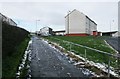
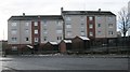
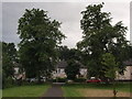
Photos of G46 8AN


Area Information
Living in Glasgow at the G46 8AN postcode offers a specific residential experience within the City of Glasgow local authority. This postcode covers a small residential cluster spanning 4,982 square metres, situating you within a focused neighbourhood. The area lies in the Lanarkshire ceremonial county, positioned near coordinates 55.880282, -4.274442. While broader G20 data mentions settlements like Possil Park and Ruchill, your immediate surroundings are defined by Dunard Street. Glasgow itself sits on the River Clyde and boasts Victorian and art nouveau architecture from its history in trade and shipbuilding. Your daily life benefits from excellent transport links and proximity to major cultural sites. The Kelvingrove Art Gallery and Glasgow Green are accessible attractions that define the city's character. You are close to a dynamic blend of history, art, and nightlife that characterises the city. The Forth and Clyde Canal runs through districts nearby, adding to the area's heritage. Daily routines involve access to bustling markets and trendy cafes found throughout the city. The residential nature of this cluster suggests a stable environment for settled families or individuals seeking a defined home base. You are positioned to enjoy the friendly community spirit known across Glasgow while maintaining a compact footprint in a specific postcode area.
- Area Type
- Postcode
- Area Size
- 4982 m²
- Population
- Not available
- Population Density
- Not available
The property market in G46 8AN centres on a small residential cluster located on Dunard Street. This postcode covers 4,982 square metres, indicating a tight-knit group of homes rather than a sprawling district. While specific sales volumes are not isolated for this exact cluster, the broader G20 area provides context for housing availability. The market here includes a mix of accommodation types common to Glasgow residential streets. You are looking at properties that serve the needs of residents in the City of Glasgow local authority. The area falls within the G20 postcode district, which includes established settlements like Ruchill and Possil Park. This suggests a stable housing environment with homes in various stages of tenure. Whether you seek owner-occupied developments or rentals, the local authority planning covers these areas. Specific data on home ownership percentages for this tiny cluster is not separately published, so you should view G20 figures as the baseline. The presence of Dunard Primary School indicates a family-friendly stock with nearby educational facilities. Buyers should consider the character of Dunard Street and the proximity to the Forth and Clyde Canal when evaluating property values. The market reflects the city's broader trend of diverse accommodation serving workers across Lanarkshire.
House Prices in G46 8AN
Showing 21 properties
| Address | Type | Beds | Baths | Last Sale Price | Last Sale Date | |
|---|---|---|---|---|---|---|
| Flat 3/2, 4 Kilmaluag Terrace, Glasgow, G46 8AN | Flat | - | - | - | - | |
| Flat 1/1, 4 Kilmaluag Terrace, Glasgow, G46 8AN | Flat | - | - | - | - | |
| Flat 2/1, 12 Kilmaluag Terrace, Glasgow, G46 8AN | Flat | - | - | - | - | |
| Flat 0/2, 4 Kilmaluag Terrace, Glasgow, G46 8AN | Flat | - | - | - | - | |
| Flat 1/2, 4 Kilmaluag Terrace, Glasgow, G46 8AN | Flat | - | - | - | - | |
| Flat 2/1, 4 Kilmaluag Terrace, Glasgow, G46 8AN | Flat | - | - | - | - | |
| 10A Kilmaluag Terrace, Glasgow, G46 8AN | house | - | - | - | - | |
| Flat 3/2, 12 Kilmaluag Terrace, Glasgow, G46 8AN | Flat | - | - | - | - | |
| Flat 1/1, 12 Kilmaluag Terrace, Glasgow, G46 8AN | Flat | - | - | - | - | |
| Flat 1/2, 12 Kilmaluag Terrace, Glasgow, G46 8AN | Flat | - | - | - | - |
Energy Efficiency in G46 8AN
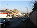
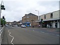
Your lifestyle in G46 8AN benefits from immediate access to a wide range of amenities within practical reach. For retail needs, you are close to the Co-op EGMF Darnley superstore alongside Farmfoods Giffnock and Sainsburys Darnley. These venues are located just five prominent shops away, ensuring you do not need to travel far for groceries or daily essentials. Transport options are equally convenient with five railway stations and five metro stations nearby. Kennishead Railway Station and Thornliebank Railway Station serve your train commuting requirements. Underground travel is accessible via Cessnock Underground Station, Kinning Park Underground Station, and Ibrox Underground Station. If you prefer water travel, the area features five ferry landing sites including Glasgow SECC Ferry Landing and Plantation Quay Ferry Landing. Glasgow International Airport is one station away for regional flights. Nature lovers can visit Glasgow Green, identified as a notable park within the city the residents enjoy. The Forth and Clyde Canal runs through nearby districts, offering views and walking paths. You also have access to Kelvingrove Art Gallery for cultural enrichment. Daily life in G46 8AN balances urban convenience with access to significant local attractions in Glasgow.
Amenities
Schools
| Rank | School | Type | Entry gender | Ages |
|---|
Explore more schools in this area
Go to Schools tabDemographics
The demographic profile for the G46 8AN postcode focuses on a specific residential cluster in Dunard Street, Glasgow. All key demographic indicators are derived from broader G20 district data where direct figures for this precise postcode cluster are aggregated. The area reflects the standard household composition and age profiles typical of residential zones within the City of Glasgow local authority. Housing stock in this neighbourhood generally consists of accommodation types found across the G20 postcode district, which encompasses areas such as Lambhill and Summerston. You can expect a mix of home ownership levels that align with the city's broader trends in Dunard Street. The diversity of the community is shaped by Glasgow's status as a major urban centre with a rich cultural heritage. Families and individuals live in this residential cluster, benefiting from the city's high density of services. There is no specific data available to detail exact age breakdowns or deprivation indices for this exact cluster, but it mirrors the statutory ward characteristics around Dunard Primary School. The community spirit remains a defining feature, with residents enjoying the benefits of a dynamic urban environment. Your neighbours are part of a city known for a friendly atmosphere and deep-rooted history in the Lanarkshire region. The housing market here reflects the needs of people working in the city centre or using regional transport links to commute.
Household Size
Accommodation Type
Tenure
Ethnic Group
Religion
Household Composition
Age
Household Deprivation
NS-SEC
Explore more demographic insights in this area
Go to Demographics tabPlanning
Planning Constraints
- Flood RiskPremium
- Ramsar Wetland SitesPremium
- Area of Outstanding Natural BeautyPremium
- Protected Nature ReservePremium
- Protected WoodlandPremium
- Crime RiskPremium