Area Overview for G43 2BS
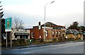
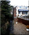
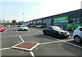
Photos of G43 2BS


Area Information
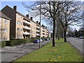
G43 2BS is a small residential postcode cluster in Scotland, situated in a region with strong historical and cultural roots. The area is defined by its compact size, offering a blend of quiet living and practical connectivity. While specific population figures are not available, the postcode’s proximity to Glasgow and its surrounding infrastructure suggests a mix of long-term residents and those drawn to the region’s amenities. The area benefits from excellent digital connectivity, with a broadband score of 99 and a mobile coverage score of 85, ensuring reliable internet access for both home and work. This makes it a viable option for professionals or remote workers. The absence of flood risk, protected natural areas, or planning constraints adds to its appeal as a stable, low-maintenance location. Though the area is small, it is positioned near transport networks, including rail, metro, and ferry services, which open up access to Glasgow’s cultural and economic hubs. Its compact nature means residents can enjoy a sense of community while remaining within reach of urban conveniences.
- Area Type
- Postcode
- Area Size
- Not available
- Population
- Not available
- Population Density
- Not available
House Prices in G43 2BS
No properties found in this postcode.
Energy Efficiency in G43 2BS
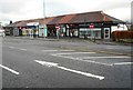
Residents of G43 2BS have access to a range of amenities within practical reach, enhancing daily life. Retail options include supermarkets such as Iceland Auldhouse, Aldi Newlands, and Morrisons Newlands, ensuring convenience for grocery shopping. The area’s transport links connect it to Glasgow’s cultural and recreational spaces, including parks like Glasgow Green and historic sites such as the Kelvingrove Art Gallery. While specific local parks or leisure facilities are not detailed, the proximity to Glasgow’s amenities means residents can enjoy a vibrant mix of activities, from markets and cafes to museums and nightlife. The presence of rail, metro, and ferry services further supports access to these attractions. The area’s compact size and connectivity make it ideal for those seeking a balance between urban and suburban living, with easy access to both local services and larger city amenities.
Amenities
Schools
| Rank | School | Type | Entry gender | Ages |
|---|
Explore more schools in this area
Go to Schools tabDemographics
Household Size
Accommodation Type
Tenure
Ethnic Group
Religion
Household Composition
Age
Household Deprivation
NS-SEC
Explore more demographic insights in this area
Go to Demographics tabPlanning
Planning Constraints
- Flood RiskPremium
- Ramsar Wetland SitesPremium
- Area of Outstanding Natural BeautyPremium
- Protected Nature ReservePremium
- Protected WoodlandPremium
- Crime & SafetyPremium