Area Overview for G42 9HF
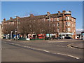
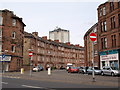
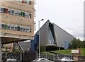
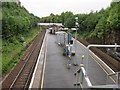
Photos of G42 9HF

Area Information
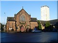
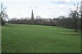
Living in G42 9HF means residing within a very specific residential cluster covering exactly 5,743 square metres located in Scotland. This postcode represents a compact living environment situated inside the G20 postcode district, which encompasses settlements such as Lambhill, Possil Park, and Ruchill. The area sits within the City of Glasgow local authority in the ceremonial county of Lanarkshire. Geography plays a significant role in daily life here, as the proximity to the River Clyde and the imposing Victorian and art nouveau architecture of the broader city define the local landscape. The G20 district itself includes the Forth and Clyde Canal, a notable waterway that runs through the surrounding neighbourhoods. You are positioned on Dunard Street, a location known for its strong connection to the City of Glasgow's history of trade and shipbuilding. Your daily life is characterised by excellent transport links that connect this small cluster to the wider urban fabric. While the immediate footprint is tiny, the G42 9HF postcode benefits from the cultural heritage and friendly community spirit associated with Glasgow. Famous attractions like the Kelvingrove Art Gallery and Glasgow Green remain accessible from your location. The area offers a dynamic blend of history and modern amenity access, allowing you to enjoy a residential setting while remaining close to bustling markets and trendy cafes found in the larger municipality.
- Area Type
- Postcode
- Area Size
- 5743 m²
- Population
- Not available
- Population Density
- Not available
Describing the property market specifically for the G42 9HF postcode is limited because the data does not include home ownership percentages, price trends, or sale volumes for this exact location. The provided information identifies the area as a small residential cluster, but it does not state whether residents primarily own their homes or rent them. While the surrounding G20 postcode district includes settlements like Lambhill and Ruchill, the specific housing stock characteristics for your 5,743 square metre plot are not detailed in the available records. It is unclear if the local housing market leans towards owner-occupied family homes or rental properties without these specific figures. The data source mentions duties for tenants and references to freeholders in the context of the area, but it does not quantify the balance between mortgages and tenancies in G42 9HF. Consequently, a prospective buyer cannot determine if this small postcode is a conventionally safe place to borrow for a mortgage based on the current evidence. The absence of specific statistics on accommodation types means you cannot easily gauge the age or variety of buildings in this cluster beyond the general description of the nearby Dunard Street location. Future research may reveal more about the transaction history, but currently, the market profile remains undefined in the provided dataset.
House Prices in G42 9HF
Showing 25 properties
| Address | Type | Beds | Baths | Last Sale Price | Last Sale Date | |
|---|---|---|---|---|---|---|
| Flat 1/1, 1143 Cathcart Road, Glasgow, G42 9HF | Flat | 1 | 1 | - | - | |
| Flat 1/2, 1143 Cathcart Road, Glasgow, G42 9HF | Flat | 1 | 1 | - | - | |
| Flat 1/1, 1131 Cathcart Road, Glasgow, G42 9HF | Flat | 1 | 1 | - | - | |
| Flat 2/1, 1137 Cathcart Road, Glasgow, G42 9HF | Flat | 1 | 1 | - | - | |
| Flat 0/2, 1143 Cathcart Road, Glasgow, G42 9HF | Flat | 1 | - | - | - | |
| Flat 3/2, 1143 Cathcart Road, Glasgow, G42 9HF | Flat | 1 | 1 | - | - | |
| Flat 3/2, 1137 Cathcart Road, Glasgow, G42 9HF | Flat | - | - | - | - | |
| Flat 0/2, 1137 Cathcart Road, Glasgow, G42 9HF | Flat | - | - | - | - | |
| Flat 2/2, 1137 Cathcart Road, Glasgow, G42 9HF | Flat | - | - | - | - | |
| Flat 1/1, 1137 Cathcart Road, Glasgow, G42 9HF | Flat | - | - | - | - |
Energy Efficiency in G42 9HF
Your lifestyle in G42 9HF benefits from an extensive network of amenities located just outside the immediate cluster but well within practical reach. You are close to five railway stations, including Mount Florida, Cathcart, and Kings Park Railway Station, providing easy rail access to broader networks. Nearby, you can access five metro stops at West Street, Shields Road, and Bridge Street Underground Station, offering convenient links into the city centre. For retail needs, five major stores serve you, featuring locations like Tesco Cathcart, Sainsburys Glasgow, and Co-op Battlefield. These venues provide everyday shopping convenience without requiring a long journey. Additional transport options include five ferry terminals, such as the Glasgow Central Station Bridge Ferry Landing and Broomielaw Quay Ferry Terminal, adding another layer of connectivity for your travels. While the area itself is small, the surrounding G20 district offers cultural activities near Kelvingrove Art Gallery and Glasgow Green. The availability of Dunard Primary School within the broader region suggests good educational foundations nearby. Residents enjoy a mix of bustling markets, trendy cafes, and beautiful parks, ensuring that daily life balances commercial convenience with leisure and culture effectively.
Amenities
Schools
| Rank | School | Type | Entry gender | Ages |
|---|
Explore more schools in this area
Go to Schools tabDemographics
Determining the specific age profile, household composition, or diversity of residents in G42 9HF is not possible at this time. The available data descriptions indicate that this is a specific postcode area covering a small residential cluster, yet detailed demographic breakdowns for this tiny footprint are not provided in the current assessment. Consequently, it remains unclear what the typical age distribution looks like for families or individuals living on Dunard Street or within the immediate 5,743 square metres. Similarly, information regarding home ownership levels and the proportion of rented versus owner-occupied properties is absent from the provided records. Without these specific figures, one cannot accurately describe the makeup of the local population or the stability of the housing stock within these boundaries. The data descriptions for other areas in the G20 district highlight features like schools and canals, but the same granular detail is missing for G42 9HF itself. Therefore, any attempt to characterise the community by income, housing type, or social demographics would rely on assumptions rather than fact. You must recognise that while the location is physically defined, the human statistics required to understand who lives in this specific cluster are currently unavailable in the provided source material.
Household Size
Accommodation Type
Tenure
Ethnic Group
Religion
Household Composition
Age
Household Deprivation
NS-SEC
Explore more demographic insights in this area
Go to Demographics tabPlanning
Planning Constraints
- Flood RiskPremium
- Ramsar Wetland SitesPremium
- Area of Outstanding Natural BeautyPremium
- Protected Nature ReservePremium
- Protected WoodlandPremium
- Crime RiskPremium