Area Overview for G41 2NB
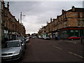
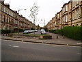
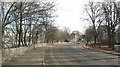
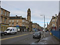
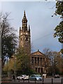
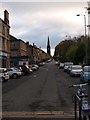
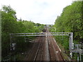
Photos of G41 2NB


Area Information
G41 2NB is a small residential cluster located within the City of Glasgow local authority. This specific postcode covers an area of just over 2,157 square metres, indicating a concentrated pocket of housing rather than a sprawling district. The location sits in a part of Glasgow known for its Victorian and art nouveau architecture, reflecting the city's historical involvement in trade and shipbuilding. Residents live in a setting that benefits from the broader G20 postcode district's reputation, which encompasses settlements like Ruchill and Possil Park. The area lies on Dunard Street, situated at coordinates 55.880282, -4.274442, placing it within Lanarkshire. Daily life here is shaped by the city's dynamic blend of history, art, and accessible attractions like the Keltingrove Art Gallery. You can find yourself near Glasgow Green, a major park that adds green space to the urban environment. This context suggests a living environment where historic character meets modern convenience, with the Forth and Clyde Canal running through nearby districts. The proximity to these established landmarks provides a sense of connectedness to wider Glasgow while maintaining a distinct local identity.
- Area Type
- Postcode
- Area Size
- 2157 m²
- Population
- Not available
- Population Density
- Not available
Specific data regarding the property market in G41 2NB, including home ownership percentages or dominant accommodation types, is not available. The postcode covers a small cluster of just 2,157 square metres, but figures detailing whether the housing stock consists primarily of flats or terraced houses are not included in the provided information. You cannot determine if this is an owner-occupied area or if it functions mainly as a rental market without further data. The lack of statistical evidence on property values, rental yields, or the sale price history for this specific postcode means that buyers must rely on broader local knowledge to gauge market trends. While the nearby areas of Ruchill and Possil Park have established housing patterns, these trends do not automatically apply to every home within the G41 2NB boundaries without specific records. Potential buyers will find it difficult to assess the precise nature of the housing supply or the stability of tenancy in this micro-zone.
House Prices in G41 2NB
Showing 21 properties
| Address | Type | Beds | Baths | Last Sale Price | Last Sale Date | |
|---|---|---|---|---|---|---|
| 221 Albert Drive, Glasgow, G41 2NB | Retail | - | - | - | - | |
| 215A Albert Drive, Glasgow, G41 2NB | Retail | - | - | - | - | |
| Flat 1/3, 205 Albert Drive, Glasgow, G41 2NB | Flat | - | - | - | - | |
| Flat 1/2, 205 Albert Drive, Glasgow, G41 2NB | Flat | - | - | - | - | |
| 213 Albert Drive, Glasgow, G41 2NB | shop | - | - | - | - | |
| Flat 2/1, 205 Albert Drive, Glasgow, G41 2NB | Flat | - | - | - | - | |
| 201 Albert Drive, Glasgow, G41 2NB | shop | - | - | - | - | |
| Flat 1/1, 205 Albert Drive, Glasgow, G41 2NB | Flat | - | - | - | - | |
| Flat 2/2, 205 Albert Drive, Glasgow, G41 2NB | Flat | - | - | - | - | |
| Flat 1/1, 217 Albert Drive, Glasgow, G41 2NB | Flat | - | - | - | - |
Energy Efficiency in G41 2NB
Living in G41 2NB offers practical access to a wide range of amenities within easy reach. Retail options include Sainsburys Glasgow, Lidl Govanhill, and Tesco Glasgow, ensuring you can shop for groceries and essentials without travelling far. Public transport links are extensive, with five railway stations nearby, including Pollokshields East, Pollokshields West, and Queens Park Railway Station. Commuters benefit from five underground stations such as Shields Road, West Street, and Kinning Park. The area also features five ferry terminals, including Broomielaw Quay and Glasgow Central Station Bridge Ferry Landing, providing alternative routes across the River Clyde. Cultural and recreational amenities are close by, with Dunard Primary School operating locally and Glasgow Green serving as a notable park. The Forth and Clyde Canal runs through the neighbouring district, adding scenic value. Residents in this postcode district can walk to these facilities or commute via the numerous tube and rail links described. This mix of shops, schools, and transit hubs provides a convenient and varied lifestyle.
Amenities
Schools
| Rank | School | Type | Entry gender | Ages |
|---|
Explore more schools in this area
Go to Schools tabDemographics
Detailed demographic statistics such as age profiles, household types, or home ownership levels are not provided for G41 2NB. Similarly, specific data regarding the diversity of the population within this postcode is absent from available records. Without concrete figures on deprivation rates or accommodation types, it is impossible to define the exact composition of the community in this specific two-and-a-half-hectare zone. While the broader area surrounding Dunard Street is part of a city described as having a friendly community spirit, these general characterisations cannot be confirmed for the specific G41 2NB cluster. Any attempt to describe the resident profile would require data that is currently unavailable. Consequently, you cannot determine the ratio of owner-occupiers to tenants or the prevalence of single-person households based on existing information for this location.
Household Size
Accommodation Type
Tenure
Ethnic Group
Religion
Household Composition
Age
Household Deprivation
NS-SEC
Explore more demographic insights in this area
Go to Demographics tabPlanning
Planning Constraints
- Flood RiskPremium
- Ramsar Wetland SitesPremium
- Area of Outstanding Natural BeautyPremium
- Protected Nature ReservePremium
- Protected WoodlandPremium
- Crime & SafetyPremium