Area Overview for G41 2DU
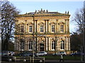
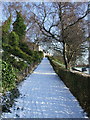
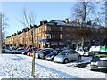
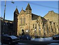
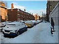
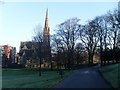
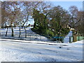
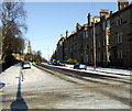
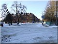
Photos of G41 2DU


Area Information
Living in G41 2DU places you in a small residential cluster within Scotland, likely characterised by a compact, community-focused layout. While specific population figures are not provided, the area benefits from proximity to Glasgow’s broader infrastructure, including transport networks and cultural hubs. The postcode’s digital connectivity is exceptional, with a broadband score of 100 and mobile coverage rated at 85, ensuring reliable internet access for both professional and personal use. Nearby, the area is served by multiple rail, metro, and ferry connections, such as Pollokshields West Railway Station and Broomielaw Quay Ferry Terminal, which facilitate easy travel to Glasgow’s city centre and beyond. The surrounding region includes historic sites like the Forth and Clyde Canal and cultural landmarks such as the Kelvingrove Art Gallery. This blend of connectivity, historical interest, and practical amenities makes G41 2DU a viable option for those seeking a balance between urban convenience and residential tranquillity.
- Area Type
- Postcode
- Area Size
- Not available
- Population
- Not available
- Population Density
- Not available
This section cannot be completed as no specific data on home ownership percentages, accommodation types, or property market trends is available in the provided information.
House Prices in G41 2DU
No properties found in this postcode.
Energy Efficiency in G41 2DU
Residents of G41 2DU have access to a range of amenities within practical reach. Retail options include M&S Pollokshaws Glasgow BP, Sainsburys Glasgow, and Co-op Shawlands, offering everyday shopping needs. The area’s transport links connect to Glasgow Green, a large public park ideal for leisure, exercise, and family activities. Cultural attractions such as the Kelvingrove Art Gallery are accessible via nearby stations, providing opportunities for art and history enthusiasts. The Forth and Clyde Canal runs through the broader district, offering scenic walking and cycling routes. Additionally, the proximity to Dunard Primary School ensures convenient access to education for local families. This mix of retail, green spaces, cultural landmarks, and transport options creates a lifestyle that balances practicality with urban amenities.
Amenities
Schools
| Rank | School | Type | Entry gender | Ages |
|---|
Explore more schools in this area
Go to Schools tabDemographics
This section cannot be completed as no demographic data—such as age profiles, household types, or diversity metrics—is provided in the available information.
Household Size
Accommodation Type
Tenure
Ethnic Group
Religion
Household Composition
Age
Household Deprivation
NS-SEC
Explore more demographic insights in this area
Go to Demographics tabPlanning
Planning Constraints
- Flood RiskPremium
- Ramsar Wetland SitesPremium
- Area of Outstanding Natural BeautyPremium
- Protected Nature ReservePremium
- Protected WoodlandPremium
- Crime & SafetyPremium