Area Overview for G40 4JB
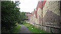
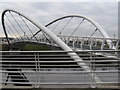
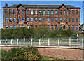
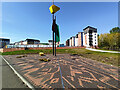
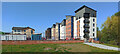
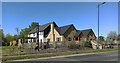
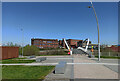
Photos of G40 4JB


Area Information
Living in G40 4JB offers a compact, residential experience in a small cluster of homes in Scotland. This postcode area is defined by its proximity to key transport hubs and retail centres, making it practical for commuters and shoppers. The area’s character is shaped by its integration with nearby infrastructure, including rail and metro stations, which connect residents to Glasgow’s broader network. While the population size and exact demographics are not specified, the presence of multiple amenities within walking distance suggests a community-oriented environment. The area’s small scale means it is likely to feel intimate, with homes situated close to essential services. For those prioritising connectivity, the high broadband score and accessible transport options make it suitable for both remote work and daily travel. The absence of natural constraints like protected woodlands or wetlands means development is not restricted, offering flexibility for future growth. However, the area’s distinctiveness lies in its balance between residential living and proximity to urban facilities, catering to those who value convenience without sacrificing a sense of locality.
- Area Type
- Postcode
- Area Size
- Not available
- Population
- Not available
- Population Density
- Not available
House Prices in G40 4JB
No properties found in this postcode.
Energy Efficiency in G40 4JB
Residents of G40 4JB have access to a range of amenities within practical reach. Retail options include Makro Shawfield and Tesco Rutherglen, offering everything from groceries to household goods. For dining and leisure, the area’s proximity to major transport hubs suggests nearby restaurants and cafes, though specific names are not listed. The presence of multiple rail and metro stations also implies easy access to cultural and entertainment venues in Glasgow. While parks or green spaces are not explicitly mentioned, the absence of protected natural areas means the area is not constrained by environmental restrictions that might limit recreational options. The cluster of amenities—retail, transport, and services—creates a convenient daily life, reducing the need for long commutes. This makes G40 4JB appealing to those who value efficiency in accessing essentials, whether for shopping, work, or socialising.
Amenities
Schools
| Rank | School | Type | Entry gender | Ages |
|---|
Explore more schools in this area
Go to Schools tabDemographics
Household Size
Accommodation Type
Tenure
Ethnic Group
Religion
Household Composition
Age
Household Deprivation
NS-SEC
Explore more demographic insights in this area
Go to Demographics tabPlanning
Planning Constraints
- Flood RiskPremium
- Ramsar Wetland SitesPremium
- Area of Outstanding Natural BeautyPremium
- Protected Nature ReservePremium
- Protected WoodlandPremium
- Crime RiskPremium