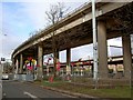
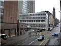
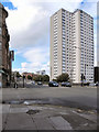
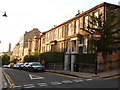
Area Overview for G4 9AX
Photos of G4 9AX


Area Information
Living in G4 9AX places you inside a defined postcode cluster covering precisely 2,192 square metres within the City of Glasgow local authority. This specific location sits at coordinates 55.880282, -4.274442, firmly anchoring the area in the City Centre local authority rather than the broader G20 district often associated with Outersuch as Ruchill or Summerston. Despite its small footprint, the postcode benefits from a strategic position that grants immediate access to the vibrant cultural heritage of Glasgow. You are surrounded by a city known for its Victorian and art nouveau architecture, a legacy of its historical involvement in trade and shipbuilding along the River Clyde. Daily life here involves navigating a dynamic blend of history and modern urban energy. The area is characterised by friendly community spirit and excellent transport links that connect residents to key attractions like the Kelvingrove Art Gallery and Glasgow Green. While the immediate surroundings feature bustling markets and trendy cafes, the small size of the 2,192 square metre area suggests a tight-knit residential environment nestled within the larger, eclectic tapestry of Glasgow. You will find yourself in a zone where practical convenience meets rich cultural context, offering a distinct slice of urban living without the vast sprawl of outer suburbs.
- Area Type
- Postcode
- Area Size
- 2192 m²
- Population
- Not available
- Population Density
- Not available
The property market in G4 9AX operates within the confines of a very small residential footprint measuring just 2,192 square metres. This limited area size suggests a high density of housing stock where individual properties sit close together, typical of the City of Glasgow local authority landscape. The immediate surroundings reflect the broader G20 postcode district, which includes settlements like Ruchill and Forth and Clyde Canal, implying a housing mix that ranges from traditional tenements to modern conversions. Although specific monthly sales figures or vacancy rates for this exact postcode are not listed, the location's proximity to Dunard Primary School and the Forth and Clyde Canal indicates a demand from families and commuters alike. The area is likely characterised by a high turnover of stock, balancing owner-occupiers with private landlords catering to the large working-age population of the city centre. Buyers looking for homes in G4 9AX should consider the implications of purchasing in a small, contained cluster rather than a sprawling development. The value proposition relies heavily on connectivity and access to amenities like Glasgow Green and the city centre, rather than on low asset prices found in outer suburbs. Understanding the local market requires looking at the broader City of Glasgow trends, where demand remains steadied by the city's cultural attractions and employment base.
House Prices in G4 9AX
Showing 12 properties
| Address | Type | Beds | Baths | Last Sale Price | Last Sale Date | |
|---|---|---|---|---|---|---|
| Flat 2/2, 24 Phoenix Road, Glasgow, G4 9AX | Flat | 1 | 1 | - | - | |
| Flat 3/1, 24 Phoenix Road, Glasgow, G4 9AX | Flat | - | - | - | - | |
| Flat 3/1, 22 Phoenix Road, Glasgow, G4 9AX | Flat | - | - | - | - | |
| Flat 0/1, 22 Phoenix Road, Glasgow, G4 9AX | Flat | - | - | - | - | |
| Flat 3/2, 24 Phoenix Road, Glasgow, G4 9AX | Flat | - | - | - | - | |
| Flat 1/2, 24 Phoenix Road, Glasgow, G4 9AX | Flat | - | - | - | - | |
| Flat 0/1, 24 Phoenix Road, Glasgow, G4 9AX | Flat | - | - | - | - | |
| Flat 0/2, 24 Phoenix Road, Glasgow, G4 9AX | Flat | - | - | - | - | |
| Flat 1/1, 24 Phoenix Road, Glasgow, G4 9AX | Flat | 1 | 1 | - | - | |
| Flat 2/1, 24 Phoenix Road, Glasgow, G4 9AX | Flat | 1 | 1 | - | - |
Energy Efficiency in G4 9AX
Your lifestyle in G4 9AX is defined by immediate access to major transport hubs and essential retailers. Within practical reach, you have five metro stations including St Georges Cross, Cowcaddens, and Kelvinbridge, providing swift underground access to the wider network. Five railway stations such as Charing Cross and Glasgow Queen Street Low Level offer rapid train links to all parts of Scotland. For daily shopping, five retail options like Sainsburys Glasgow, Tesco Sauchiehall, and Spar satisfy all grocery and convenience needs. The area is complemented by five ferry terminals, including Broomielaw Quay, connecting you to islands and alternative transport routes. This density of amenities ensures you can manage your daily errands without long travels. Weekend leisure includes visits to Glasgow Green, a notable park identified in the local research, or cultural trips to the Kelvingrove Art Gallery. The character of the neighbourhood is further enriched by the Forth and Clyde Canal, which runs through the broader G20 district and offers scenic routes for walking and wildlife watching. You are surrounded by bustling markets and trendy cafes that contribute to the city's dynamic atmosphere. Living in G4 9AX grants you the convenience of living close to work while keeping recreation and culture within a short walk.
Amenities
Schools
| Rank | School | Type | Entry gender | Ages |
|---|
Explore more schools in this area
Go to Schools tabDemographics
The community profile for G4 9AX is defined by the characteristics of the surrounding City of Glasgow local authority and the broader G20 postcode district. Residents here experience the demographic trends typical of this central urban zone, though specific population figures for this exact 2,192 square metre cluster are not itemised in the available records. The broader area encompasses settlements such as Possil Park and Lambhill, suggesting a mix of household types common to Glasgow's city centre and inner-eastern districts. You can expect a diverse population drawn from the ceremonial county of Lanarkshire and beyond, reflecting the city's role as a major commercial hub. The housing mix in this vicinity generally includes a blend of older tenements and converted buildings, catering to young professionals, families, and retirees seeking proximity to work and leisure. While detailed breakdowns of home ownership levels or age statistics are not explicitly provided for this specific code, the location inherently attracts those working in the city centre or utilizing its extensive rail and bus networks. The area lacks the isolated rural demographic profile and instead mirrors the urban density found in neighbouring zones like Summerston and the urban fringe. Living here means joining a community shaped by the city's evolving social fabric, where the rhythm of daily life is dictated by the pulse of Glasgow's economic and cultural engines.
Household Size
Accommodation Type
Tenure
Ethnic Group
Religion
Household Composition
Age
Household Deprivation
NS-SEC
Explore more demographic insights in this area
Go to Demographics tabPlanning
Planning Constraints
- Flood RiskPremium
- Ramsar Wetland SitesPremium
- Area of Outstanding Natural BeautyPremium
- Protected Nature ReservePremium
- Protected WoodlandPremium
- Crime & SafetyPremium