Area Overview for G32 8XA
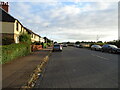
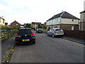
Photos of G32 8XA


Area Information
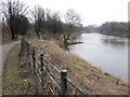
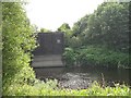
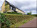
G32 8XA is a small residential postcode area in Scotland, covering 38.6 hectares. It forms a compact cluster of homes, offering a mix of proximity to urban amenities and a quieter residential feel. The area’s proximity to multiple transport hubs, including rail, metro, and ferry services, makes it accessible for commuters and those reliant on public transport. Residents benefit from strong digital connectivity, with broadband scores in the excellent range and mobile coverage rated as good. However, the area faces a critical flood risk, a factor that buyers should consider carefully. Despite this, G32 8XA’s location near retail outlets like Asda Fullarton and Lidl Rutherglen, alongside transport links such as Rutherglen Railway Station, ensures daily life is convenient. The area’s small size means it is likely to have a tight-knit community, though specific details on demographics remain absent from the data. For those prioritising connectivity and proximity to major transport routes, G32 8XA presents a practical choice, though flood risk remains a key consideration.
- Area Type
- Postcode
- Area Size
- 38.6 hectares
- Population
- Not available
- Population Density
- Not available
House Prices in G32 8XA
Showing 1 properties
| Address | Type | Beds | Baths | Last Sale Price | Last Sale Date | |
|---|---|---|---|---|---|---|
| 1780 London Road, Glasgow, G32 8XA | warehouse | - | - | - | - |
Energy Efficiency in G32 8XA
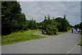
Living in G32 8XA grants access to a range of amenities within walking or short transit distance. Retail options include Asda Fullarton, Lidl Rutherglen, and Lidl Shettleston, providing everyday shopping convenience. The area’s transport links connect residents to major hubs like Glasgow, while ferry services offer direct routes across the Clyde. While specific parks or leisure facilities are not detailed in the data, the proximity to rail and metro stations suggests easy access to larger urban amenities. The presence of multiple retail and transport points indicates a functional, service-oriented lifestyle. However, the lack of named parks or recreational spaces in the data means the area’s green spaces remain unspecified. For those prioritising retail and transport accessibility, G32 8XA offers a practical, if compact, living environment.
Amenities
Schools
| Rank | School | Type | Entry gender | Ages |
|---|
Explore more schools in this area
Go to Schools tabDemographics
Household Size
Accommodation Type
Tenure
Ethnic Group
Religion
Household Composition
Age
Household Deprivation
NS-SEC
Explore more demographic insights in this area
Go to Demographics tabPlanning
Planning Constraints
- Flood RiskPremium
- Ramsar Wetland SitesPremium
- Area of Outstanding Natural BeautyPremium
- Protected Nature ReservePremium
- Protected WoodlandPremium
- Crime RiskPremium