Area Overview for G32 8TG
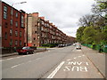
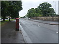
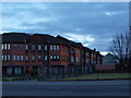
Photos of G32 8TG


Area Information
G32 8TG is a specific postcode covering a small residential cluster with a total area size of 4859 square metres. Located in Scotland, this area represents a concentrated living environment rather than a sprawling district. The physical footprint is limited, suggesting a high density of housing or a tight-knit neighbourhood where residents are neighbours by proximity. Living in G32 8TG means navigating a compact space where daily necessities are likely within a short walk. The area forms part of the broader Glasgow context, situated within the City of Glasgow local authority. Despite the small size, the location offers access to significant regional infrastructure. Residents here benefit from a defined boundary that provides a sense of enclosure and community identity. The postcode acts as a specific address point, distinct from the larger G20 postcode district which encompasses wider settlements like Lambhill and Possil Park. This specificity matters for those seeking precise location information when buying homes in G32 8TG. The area size confirms that this is a micro-locality, perfect for those who prefer a focused residential setting over the dispersed nature of larger districts.
- Area Type
- Postcode
- Area Size
- 4859 m²
- Population
- Not available
- Population Density
- Not available
Specific data regarding the property market for G32 8TG is not available. We cannot determine the percentage of owner-occupied homes or identify the predominant types of accommodation within this 4859 square metre postcode. It is unclear whether the housing stock consists mainly of flats, terraced houses, or semi-detached homes. Without home ownership percentages or inventory counts, we cannot describe whether this is a rental market dominated by landlords or a stable owner-occupier community. Buyers looking at homes in G32 8TG lack the quantitative evidence needed to assess price trends or vacancy rates. The small size of the area suggests a limited number of properties, which means individual listings can significantly influence local market dynamics. However, without concrete figures on property types or ownership levels, any description of the housing stock remains theoretical. Prospective purchasers must look beyond this specific postcode for broader district data to understand the typical characteristics of properties in the surrounding region.
House Prices in G32 8TG
Showing 56 properties
| Address | Type | Beds | Baths | Last Sale Price | Last Sale Date | |
|---|---|---|---|---|---|---|
| Flat 3/1, 548 Tollcross Road, Glasgow, G32 8TG | Flat | 1 | - | - | - | |
| Flat 2/1, 524 Tollcross Road, Glasgow, G32 8TG | Flat | - | - | - | - | |
| Flat 2/2, 518 Tollcross Road, Glasgow, G32 8TG | Flat | - | - | - | - | |
| Flat 0/2, 518 Tollcross Road, Glasgow, G32 8TG | Flat | - | - | - | - | |
| Flat 0/1, 518 Tollcross Road, Glasgow, G32 8TG | Flat | - | - | - | - | |
| Flat 1/2, 518 Tollcross Road, Glasgow, G32 8TG | Flat | - | - | - | - | |
| Flat 1/1, 518 Tollcross Road, Glasgow, G32 8TG | Flat | - | - | - | - | |
| Flat 1/1, 524 Tollcross Road, Glasgow, G32 8TG | Flat | - | - | - | - | |
| Flat 3/2, 524 Tollcross Road, Glasgow, G32 8TG | Flat | - | - | - | - | |
| Flat 2/1, 518 Tollcross Road, Glasgow, G32 8TG | Flat | - | - | - | - |
Energy Efficiency in G32 8TG
Living in G32 8TG places you within practical reach of essential amenities across several categories. Retail options include Lidl Shettleston, Co-op Tollcross, and Farmfoods Parkhead, ensuring daily shopping needs are met quickly. You have access to five retail outlets that cover a variety of grocery and household requirements. For commuters, rail connectivity is robust with five stations available, including Carntyne Railway Station, Shettleston Railway Station, and Dalmarnock Railway Station. These stations provide direct links to broader transport networks. Underground travel is accessible through five metro stations such as St Enoch Underground Station, Buchanan Street Underground Station, and Bridge Street Underground Station. Additionally, ferry services operate from five terminals like Glasgow Central Station Bridge Ferry Landing and Broomielaw Quay Ferry Terminal. This diverse transport mix offers flexibility for travel beyond the city. The combination of shops and stations means you can start your day with coffee near a station or pick up groceries after work. This density of amenities within a specific postcode area creates a convenient hub for daily life without requiring long journeys.
Amenities
Schools
| Rank | School | Type | Entry gender | Ages |
|---|
Explore more schools in this area
Go to Schools tabDemographics
There is no specific data provided regarding the demographic breakdown of G32 8TG. Consequently, details on age profiles, household types, or the diversity of the community remain unavailable for this specific postcode. Without figures on household ownership levels or accommodation types, it is impossible to describe whether the residents are primarily young professionals, families, or retirees. The lack of statistical information means we cannot define the sociological fabric of the 4859 square metre area. Any assumption about the age distribution or the mix of tenant versus owner-occupier status would be pure speculation. Potential buyers seeking insight into the typical resident or the social composition of the neighbourhood must rely on broader Glasgow statistics rather than localised data for this specific point. The absence of these metrics highlights a gap in granular analysis for this small residential cluster. Until specific census or survey data becomes available for G32 8TG, the community character remains an undefined variable for prospective homeowners.
Household Size
Accommodation Type
Tenure
Ethnic Group
Religion
Household Composition
Age
Household Deprivation
NS-SEC
Explore more demographic insights in this area
Go to Demographics tabPlanning
Planning Constraints
- Flood RiskPremium
- Ramsar Wetland SitesPremium
- Area of Outstanding Natural BeautyPremium
- Protected Nature ReservePremium
- Protected WoodlandPremium
- Crime RiskPremium