Area Overview for G3 8LT
Photos of G3 8LT


Area Information
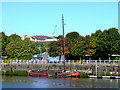
Living in G3 8LT means inhabiting a compact residential cluster in Scotland, where the area size of 7,988 square metres supports a tight-knit community. This postcode is part of Glasgow’s broader urban fabric, benefiting from the city’s historic trade and shipbuilding legacy. Residents here are likely to find a mix of older and newer housing stock, reflecting Glasgow’s architectural evolution. The area’s proximity to key transport networks, including railway stations and metro stops, ensures easy access to the city’s cultural and commercial hubs. Daily life here is shaped by the availability of retail outlets like Sainsburys Glasgow and Morrisons Daily, alongside ferry services that connect to Glasgow’s waterfront. The digital connectivity scores—93 for broadband and 85 for mobile—suggest reliable internet access, ideal for remote work or streaming. While specific data on population demographics is absent, the area’s small size implies a manageable, community-oriented environment. G3 8LT sits at the intersection of practicality and accessibility, offering residents a base from which to explore Glasgow’s parks, galleries, and historic sites.
- Area Type
- Postcode
- Area Size
- 7988 m²
- Population
- Not available
- Population Density
- Not available
The property market in G3 8LT is shaped by its small size and residential focus, though specific data on home ownership percentages or property types is not available. The area’s compact nature suggests a limited housing stock, likely consisting of terraced or semi-detached homes typical of Glasgow’s urban layout. Given the absence of detailed market statistics, it is unclear whether the area is primarily owner-occupied or rental-focused. However, the proximity to transport links and amenities may attract buyers seeking convenience over large properties. The lack of data on property prices or market trends means potential buyers should consider nearby areas for comparative insights. For those prioritising accessibility, G3 8LT’s position near railway stations and the M8 motorway could be a significant draw, though the small footprint means the immediate surroundings are key to understanding housing options.
House Prices in G3 8LT
Showing 1 properties
| Address | Type | Beds | Baths | Last Sale Price | Last Sale Date | |
|---|---|---|---|---|---|---|
| 36A St Vincent Crescent, Glasgow, G3 8LT | Industrial | - | - | - | - |
Energy Efficiency in G3 8LT
Life in G3 8LT is defined by proximity to a range of amenities, from retail outlets like Sainsburys Glasgow and Tesco Yorkhill to transport hubs such as Charing Cross Railway Station. The area’s access to ferry services, including Glasgow SECC Ferry Landing, connects residents to Glasgow’s waterfront and cultural sites like the Kelvingrove Art Gallery. Parks such as Glasgow Green, though not explicitly named in the data, are likely within reach given the area’s integration with the city. The presence of Dunard Primary School and nearby leisure facilities suggests a balance between practicality and community life. While specific dining options are not listed, the density of retail and transport links implies a variety of local eateries and cafes. The area’s compact nature means amenities are walkable, fostering a lifestyle that prioritises convenience and connectivity over sprawling suburban sprawl.
Amenities
Schools
| Rank | School | Type | Entry gender | Ages |
|---|
Explore more schools in this area
Go to Schools tabDemographics
The demographics of G3 8LT are not explicitly detailed in the data, but the area’s small size and residential focus suggest a mix of household types, likely including families and professionals. Glasgow’s broader context indicates a diverse population, though specific figures on age distribution, home ownership rates, or deprivation levels are not provided. The absence of detailed statistics means assumptions about the community’s character must be avoided. However, the area’s proximity to amenities like Dunard Primary School and parks such as Glasgow Green implies a family-friendly environment. Without concrete data on deprivation, it is unclear how economic factors might influence quality of life here. The lack of specific figures means this section focuses on observable features, such as the area’s integration with Glasgow’s transport and retail networks, rather than speculative demographic trends.
Household Size
Accommodation Type
Tenure
Ethnic Group
Religion
Household Composition
Age
Household Deprivation
NS-SEC
Explore more demographic insights in this area
Go to Demographics tabPlanning
Planning Constraints
- Flood RiskPremium
- Ramsar Wetland SitesPremium
- Area of Outstanding Natural BeautyPremium
- Protected Nature ReservePremium
- Protected WoodlandPremium
- Crime & SafetyPremium