Area Overview for G3 6WH
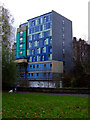
Photos of G3 6WH


Area Information
G3 6WH is a small residential postcode cluster in Glasgow, Scotland, positioned within the city’s historic and evolving urban fabric. While specific population figures are not detailed, the area benefits from proximity to Glasgow’s central transport hubs and cultural landmarks. Residents here likely enjoy a mix of urban convenience and the city’s storied heritage, with easy access to retail, public transport, and ferry services. The postcode’s compact nature suggests a tight-knit community, though its exact demographic profile remains unquantified. Glasgow’s reputation as a city of Victorian architecture, vibrant markets, and green spaces like Glasgow Green is reflected in the broader area, even if G3 6WH itself lacks explicit data on parks or specific landmarks. The area’s connectivity to metro, rail, and ferry networks positions it as a practical choice for commuters and those seeking mobility within the city. With broadband and mobile scores of 83 and 85 respectively, digital infrastructure here is robust, supporting both professional and personal needs. While no detailed historical or cultural context is provided for G3 6WH specifically, its location in Glasgow implies access to the city’s rich cultural offerings, from art galleries to historic sites.
- Area Type
- Postcode
- Area Size
- Not available
- Population
- Not available
- Population Density
- Not available
House Prices in G3 6WH
No properties found in this postcode.
Energy Efficiency in G3 6WH
Living in G3 6WH offers access to a range of retail and leisure options within walking distance. Local supermarkets like Sainsburys Glasgow, Co-op Glasgow, and Tesco Sauchiehall provide everyday shopping convenience. The area’s proximity to metro stations and rail links also opens up access to Glasgow’s broader amenities, including markets, cafes, and cultural attractions. While no specific parks or green spaces are listed for G3 6WH itself, the broader Glasgow area includes notable sites like Glasgow Green, which is accessible via the city’s transport network. The presence of ferry terminals suggests opportunities for waterfront activities or scenic travel. The area’s transport links also facilitate visits to landmarks such as the Kelvingrove Art Gallery, though specific details on local leisure facilities are not provided. Overall, the combination of retail, transport, and city-wide attractions positions G3 6WH as a practical base for those seeking urban convenience without sacrificing access to Glasgow’s cultural and recreational offerings.
Amenities
Schools
| Rank | School | Type | Entry gender | Ages |
|---|
Explore more schools in this area
Go to Schools tabDemographics
Household Size
Accommodation Type
Tenure
Ethnic Group
Religion
Household Composition
Age
Household Deprivation
NS-SEC
Explore more demographic insights in this area
Go to Demographics tabPlanning
Planning Constraints
- Flood RiskPremium
- Ramsar Wetland SitesPremium
- Area of Outstanding Natural BeautyPremium
- Protected Nature ReservePremium
- Protected WoodlandPremium
- Crime & SafetyPremium