Area Overview for G3 6EB
Photos of G3 6EB


Area Information
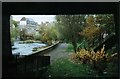
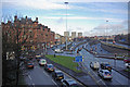
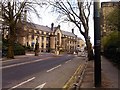
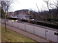
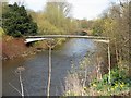
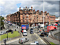
G3 6EB is a small residential postcode cluster in Glasgow, Scotland, situated within the City of Glasgow local authority. As a compact area, it benefits from proximity to key transport hubs and retail centres, making it a practical choice for those prioritising connectivity. The postcode is part of a broader network of Glasgow’s historic and modern districts, though specific details about its population or size are not publicly detailed. Residents here are likely to find a balance between urban convenience and the city’s cultural offerings. Nearby, the Forth and Clyde Canal runs through the region, a legacy of Glasgow’s 18th-century trade and shipbuilding heritage. While the area lacks specific data on its demographics, its strategic location near multiple transport nodes suggests it may appeal to professionals seeking ease of movement. The presence of retail outlets like Sainsburys Glasgow and Co-op Glasgow, combined with access to metro, rail, and ferry services, positions G3 6EB as a functional part of Glasgow’s urban fabric.
- Area Type
- Postcode
- Area Size
- Not available
- Population
- Not available
- Population Density
- Not available
House Prices in G3 6EB
No properties found in this postcode.
Energy Efficiency in G3 6EB
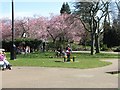
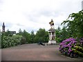
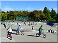
Daily life in G3 6EB is shaped by its proximity to essential amenities. Retail options include Sainsburys Glasgow, Co-op Glasgow, and Tesco North, ensuring grocery and household needs are met locally. The area’s transport network also grants access to Glasgow’s cultural and recreational spaces, though specific parks or leisure venues within G3 6EB itself are not detailed in the data. Nearby, Glasgow Green — a historic park — is a notable feature of the broader city, offering green space for relaxation. The presence of multiple metro, rail, and ferry stations means residents can quickly reach the city’s markets, cafes, and attractions. While the area’s exact character is not fully described, its connectivity to Glasgow’s vibrant urban core suggests a lifestyle that balances convenience with access to the city’s dynamic energy.
Amenities
Schools
| Rank | School | Type | Entry gender | Ages |
|---|
Explore more schools in this area
Go to Schools tabDemographics
Household Size
Accommodation Type
Tenure
Ethnic Group
Religion
Household Composition
Age
Household Deprivation
NS-SEC
Explore more demographic insights in this area
Go to Demographics tabPlanning
Planning Constraints
- Flood RiskPremium
- Ramsar Wetland SitesPremium
- Area of Outstanding Natural BeautyPremium
- Protected Nature ReservePremium
- Protected WoodlandPremium
- Crime & SafetyPremium