Area Overview for G22 7UP
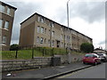
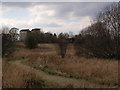
Photos of G22 7UP
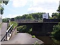

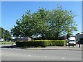
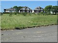
![Balmore Road [A879], Lambhill, Glasgow in G22 7UP](https://images.propbar.co.uk/images/geograph/62/05/6205887_120.jpg)
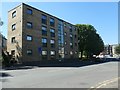
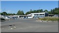
![Balmore Road [A879] in Lambhill in G22 7UP](https://images.propbar.co.uk/images/geograph/62/05/6205907_120.jpg)
Area Information
G22 7UP is a small residential postcode in Glasgow, Scotland, encompassing a compact cluster of homes within the broader G20 postcode district. The area spans 2.9 hectares, a size typical of urban residential zones in Glasgow. Located near the Forth and Clyde Canal, it benefits from proximity to both historical and modern infrastructure. The city’s Victorian and art nouveau architecture, shaped by its 18th-century shipbuilding legacy, adds to the area’s character. Residents here enjoy access to Glasgow’s cultural landmarks, such as the Kelvingrove Art Gallery, and its vibrant public spaces like Glasgow Green. The area is well-served by transport links, including railway and metro stations, making it convenient for commuters. With a mix of local amenities and easy access to the city’s amenities, G22 7UP offers a balance of urban convenience and residential tranquillity.
- Area Type
- Postcode
- Area Size
- 2.9 hectares
- Population
- Not available
- Population Density
- Not available
House Prices in G22 7UP
Showing 1 properties
| Address | Type | Beds | Baths | Last Sale Price | Last Sale Date | |
|---|---|---|---|---|---|---|
| 200 Glentanar Road, Glasgow, G22 7UP | Industrial | - | - | - | - |
Energy Efficiency in G22 7UP
Living in G22 7UP offers access to a range of amenities within practical reach. Retail options include Farmfoods Possil, Lidl Possil, and Iceland Glasgow, providing everyday shopping convenience. The area’s proximity to the Forth and Clyde Canal and Glasgow Green offers opportunities for outdoor activities, while the Kelvingrove Art Gallery nearby adds cultural value. Public transport links to metro and rail stations ensure easy access to the city’s attractions, including markets, cafes, and nightlife. The presence of Dunard Primary School and nearby leisure facilities like the Riverside Museum ferry landing contribute to a well-rounded lifestyle. This combination of local services and urban connectivity makes G22 7UP a practical choice for those seeking convenience without sacrificing access to Glasgow’s broader offerings.
Amenities
Schools
| Rank | School | Type | Entry gender | Ages |
|---|
Explore more schools in this area
Go to Schools tabDemographics
Household Size
Accommodation Type
Tenure
Ethnic Group
Religion
Household Composition
Age
Household Deprivation
NS-SEC
Explore more demographic insights in this area
Go to Demographics tabPlanning
Planning Constraints
- Flood RiskPremium
- Ramsar Wetland SitesPremium
- Area of Outstanding Natural BeautyPremium
- Protected Nature ReservePremium
- Protected WoodlandPremium
- Crime RiskPremium