Area Overview for G2 5LE
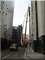
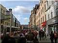
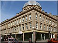
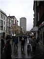
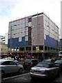
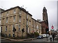
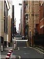
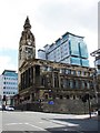
Photos of G2 5LE


Area Information
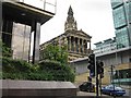
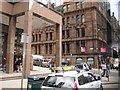
G2 5LE is a small residential postcode in Glasgow, Scotland, situated within the G20 postcode district. This area is part of the City of Glasgow local authority and lies near the River Clyde, a historic waterway central to Glasgow’s 18th-century trade and shipbuilding legacy. The postcode covers a compact cluster of homes, with Dunard Street as a notable thoroughfare. Glasgow’s Victorian and art nouveau architecture is evident nearby, reflecting the city’s industrial past. Residents benefit from proximity to cultural landmarks such as the Kelvingrove Art Gallery and the bustling Glasgow Green, a public park at the heart of the city. The area is well-connected to transport networks, including underground stations, rail services, and ferry terminals, making it convenient for commuting. Daily life here blends urban convenience with access to green spaces, markets, and a vibrant mix of cafes and shops. The community is described as friendly, with a strong sense of local identity, though the area’s compact size means it’s best suited for those who prefer a central, lively lifestyle over expansive suburban settings.
- Area Type
- Postcode
- Area Size
- Not available
- Population
- Not available
- Population Density
- Not available
House Prices in G2 5LE
No properties found in this postcode.
Energy Efficiency in G2 5LE
Living in G2 5LE offers access to a range of amenities within practical reach. Retail options include major chains like Tesco Hope, Sainsburys Glasgow, and M&S Glasgow Central Rail SF, ensuring everyday shopping needs are met. The area’s transport links connect residents to Glasgow’s cultural and recreational hubs, such as Glasgow Green, a historic park ideal for leisurely strolls or picnics. Nearby, the Forth and Clyde Canal adds a scenic element to the urban landscape. Educational facilities include Dunard Primary School, serving local families. While specific dining options aren’t listed, the proximity to the city centre suggests a variety of restaurants and cafes. The blend of retail, green spaces, and transport access creates a dynamic lifestyle, balancing urban convenience with community-oriented living.
Amenities
Schools
| Rank | School | Type | Entry gender | Ages |
|---|
Explore more schools in this area
Go to Schools tabDemographics
Household Size
Accommodation Type
Tenure
Ethnic Group
Religion
Household Composition
Age
Household Deprivation
NS-SEC
Explore more demographic insights in this area
Go to Demographics tabPlanning
Planning Constraints
- Flood RiskPremium
- Ramsar Wetland SitesPremium
- Area of Outstanding Natural BeautyPremium
- Protected Nature ReservePremium
- Protected WoodlandPremium
- Crime & SafetyPremium