Area Overview for G2 4HA
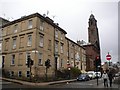
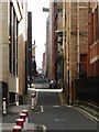
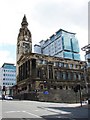
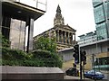
Photos of G2 4HA


Area Information
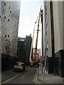
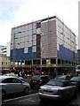
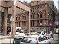
Living in G2 4HA means being part of a small, tightly knit residential cluster in Glasgow, Scotland. Situated in the City of Glasgow local authority, this postcode is nestled within a historic urban fabric shaped by the River Clyde and 18th-century trade and shipbuilding. The area is close to the Forth and Clyde Canal, a key transport and recreational corridor, and within reach of landmarks like Kelvingrove Art Gallery and Glasgow Green. With an area size of 370 m², it offers a compact living environment that balances proximity to the city’s cultural and economic hubs with a sense of community. The postcode is part of the broader G20 district, which includes nearby settlements such as Possil Park and Ruchill. Daily life here benefits from excellent transport links, including multiple railway stations and underground metro stops, as well as ferry terminals along the Clyde. The area’s mix of Victorian architecture, modern retail, and green spaces creates a dynamic living experience for residents seeking both history and convenience.
- Area Type
- Postcode
- Area Size
- 370 m²
- Population
- Not available
- Population Density
- Not available
House Prices in G2 4HA
Showing 1 properties
| Address | Type | Beds | Baths | Last Sale Price | Last Sale Date | |
|---|---|---|---|---|---|---|
| 103 Douglas Street, Glasgow, G2 4HA | Office | - | - | - | - |
Energy Efficiency in G2 4HA
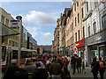
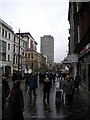
G2 4HA offers a lifestyle rich in cultural and practical amenities. Within practical reach are five retail hubs, including Tesco Hope and Tesco Glasgow, ensuring everyday shopping needs are met. The area’s proximity to Glasgow Green provides a green space for relaxation, while the Forth and Clyde Canal offers scenic walks and recreational opportunities. Dunard Primary School is a key local institution, and the Kelvingrove Art Gallery is a short distance away, enriching cultural life. The mix of historic architecture, trendy cafes, and bustling markets reflects Glasgow’s character. With multiple transport options and a blend of natural and urban spaces, G2 4HA caters to both convenience and quality of life, making it appealing to a range of residents.
Amenities
Schools
| Rank | School | Type | Entry gender | Ages |
|---|
Explore more schools in this area
Go to Schools tabDemographics
Household Size
Accommodation Type
Tenure
Ethnic Group
Religion
Household Composition
Age
Household Deprivation
NS-SEC
Explore more demographic insights in this area
Go to Demographics tabPlanning
Planning Constraints
- Flood RiskPremium
- Ramsar Wetland SitesPremium
- Area of Outstanding Natural BeautyPremium
- Protected Nature ReservePremium
- Protected WoodlandPremium
- Crime & SafetyPremium