Area Overview for G2 2UB
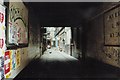
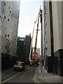
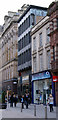
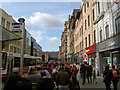
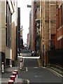
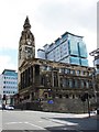
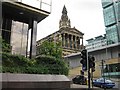
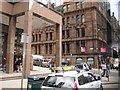
Photos of G2 2UB
Area Information
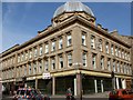
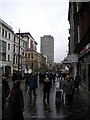
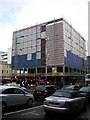
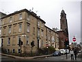
Living in G2 2UB means being part of a compact residential cluster in Glasgow, Scotland. This postcode sits within the G20 district, which includes areas like Forth and Clyde Canal, Lambhill, and Possil Park. The area benefits from Glasgow’s historic roots, with Victorian and art nouveau architecture reflecting the city’s 18th-century shipbuilding and trade legacy. Proximity to the River Clyde and nearby parks like Glasgow Green offer green spaces for recreation, while the city’s cultural hubs—such as the Kelvingrove Art Gallery—are easily accessible. G2 2UB is well-connected to transport networks, including underground stations, rail lines, and ferry terminals, making it convenient for commuters. The area’s mix of retail outlets, from major supermarkets like Tesco and Sainsburys to local markets, supports daily life. Its compact size means residents can enjoy a blend of urban amenities and community spirit, with a focus on practical living that balances convenience and historical charm.
- Area Type
- Postcode
- Area Size
- Not available
- Population
- Not available
- Population Density
- Not available
House Prices in G2 2UB
No properties found in this postcode.
Energy Efficiency in G2 2UB
Daily life in G2 2UB is enriched by nearby amenities. The area has five retail outlets, including Tesco Glasgow and Sainsburys Buchanan, offering grocery and household essentials. Public transport hubs like Buchanan Street Underground Station and Glasgow Central Railway Station provide seamless access to the city’s cultural and commercial centres. Parks such as Glasgow Green are within reach, offering open space for walks or relaxation. The Forth and Clyde Canal runs through the district, adding to the area’s scenic appeal. Nearby, the Kelvingrove Art Gallery and other attractions highlight Glasgow’s cultural vibrancy. These amenities create a balance between urban convenience and recreational opportunities, supporting a lifestyle that blends practicality with access to the city’s heritage and modern facilities.
Amenities
Schools
| Rank | School | Type | Entry gender | Ages |
|---|
Explore more schools in this area
Go to Schools tabDemographics
Household Size
Accommodation Type
Tenure
Ethnic Group
Religion
Household Composition
Age
Household Deprivation
NS-SEC
Explore more demographic insights in this area
Go to Demographics tabPlanning
Planning Constraints
- Flood RiskPremium
- Ramsar Wetland SitesPremium
- Area of Outstanding Natural BeautyPremium
- Protected Nature ReservePremium
- Protected WoodlandPremium
- Crime & SafetyPremium