Area Overview for G14 0XN
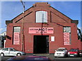
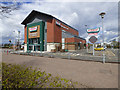
Photos of G14 0XN


Area Information
Living in G14 0XN offers a compact residential experience within Glasgow’s broader urban fabric. This postcode covers 11.6 hectares, a small but well-defined cluster of homes nestled in the city’s western reaches. Proximity to key landmarks like Glasgow Green and the Forth and Clyde Canal underscores its blend of urban convenience and natural access. The area benefits from a strategic location near major transport hubs, including rail, metro, and ferry services, which connect residents to Glasgow’s cultural and economic heart. With broadband scores nearing excellence and mobile coverage rated as good, daily life here is digitally enabled, supporting remote work and seamless connectivity. The presence of Dunard Primary School and nearby retail options like Tesco Glasgow and M&S Braehead highlights a balance of practicality and community amenities. While G14 0XN is not a sprawling suburb, its size ensures a tight-knit feel, where residents can navigate the area on foot or by bike, avoiding the congestion of larger urban zones. This postcode is ideal for those seeking a manageable, connected lifestyle with easy access to both local services and the city’s wider offerings.
- Area Type
- Postcode
- Area Size
- 11.6 hectares
- Population
- Not available
- Population Density
- Not available
House Prices in G14 0XN
No properties found in this postcode.
Energy Efficiency in G14 0XN
Life in G14 0XN is enriched by a mix of practical amenities and cultural attractions. Retail options include major supermarkets like Tesco Glasgow and Iceland Knightswood, while the Braehead Shopping Centre offers a broader range of stores and dining choices. The area’s proximity to Glasgow Green provides a green space for leisure, exercise, and community events, complemented by the historical Forth and Clyde Canal, which runs through the district. Dunard Primary School is a key local institution, ensuring educational needs are met for families. The presence of multiple railway and metro stations, along with ferry access, means residents can easily reach the city’s vibrant hubs, from the Kelvingrove Art Gallery to the bustling Merchant City. This blend of local convenience and wider connectivity fosters a dynamic lifestyle, where daily errands are efficient, and cultural opportunities are within reach. The area’s compact size ensures amenities are never far, whether for a quick coffee or a weekend outing.
Amenities
Schools
| Rank | School | Type | Entry gender | Ages |
|---|
Explore more schools in this area
Go to Schools tabDemographics
Household Size
Accommodation Type
Tenure
Ethnic Group
Religion
Household Composition
Age
Household Deprivation
NS-SEC
Explore more demographic insights in this area
Go to Demographics tabPlanning
Planning Constraints
- Flood RiskPremium
- Ramsar Wetland SitesPremium
- Area of Outstanding Natural BeautyPremium
- Protected Nature ReservePremium
- Protected WoodlandPremium
- Crime & SafetyPremium