Area Overview for G13 9DT
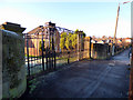
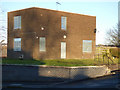
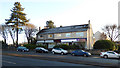
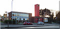
Photos of G13 9DT


Area Information
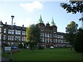
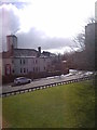
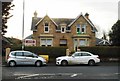
G13 9DT is a small residential postcode nestled in Glasgow, Scotland, offering a blend of urban convenience and proximity to natural and cultural assets. The area is part of the broader Glasgow postcode network, which is historically tied to the city’s role as a hub of trade and industry. While specific details about G13 9DT’s population or size are not provided, it is likely a compact cluster of homes benefiting from Glasgow’s well-established transport infrastructure. The nearby Forth and Clyde Canal, which runs through the G20 postcode district, suggests a connection to recreational waterways, though G13 9DT itself may not be directly adjacent to it. Glasgow’s reputation as a city with a rich cultural heritage and friendly community spirit extends to this area, where residents can access landmarks such as the Kelvingrove Art Gallery and Glasgow Green. The postcode’s proximity to major transport routes, including rail, metro, and ferry services, underscores its accessibility for both daily commutes and leisure travel.
- Area Type
- Postcode
- Area Size
- Not available
- Population
- Not available
- Population Density
- Not available
House Prices in G13 9DT
No properties found in this postcode.
Energy Efficiency in G13 9DT
Living in G13 9DT grants access to a range of amenities within walking or short transit distance. Retail options include Farmfoods Scotstoun, Tesco Glasgow, and Iceland Knightswood, catering to everyday shopping needs. The area’s proximity to Glasgow Green—a historic park offering open space and recreational opportunities—adds to its appeal. Nearby, the Forth and Clyde Canal provides a scenic backdrop for leisure activities, though specific recreational facilities along the canal are not detailed. Cultural landmarks like the Kelvingrove Art Gallery are accessible from the broader G20 postcode district, suggesting that G13 9DT residents can enjoy Glasgow’s arts scene without long commutes. The presence of multiple transport hubs also enhances convenience, allowing easy access to dining, entertainment, and services across the city.
Amenities
Schools
| Rank | School | Type | Entry gender | Ages |
|---|
Explore more schools in this area
Go to Schools tabDemographics
Household Size
Accommodation Type
Tenure
Ethnic Group
Religion
Household Composition
Age
Household Deprivation
NS-SEC
Explore more demographic insights in this area
Go to Demographics tabPlanning
Planning Constraints
- Flood RiskPremium
- Ramsar Wetland SitesPremium
- Area of Outstanding Natural BeautyPremium
- Protected Nature ReservePremium
- Protected WoodlandPremium
- Crime & SafetyPremium