Area Overview for G12 9TT
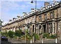
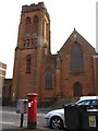
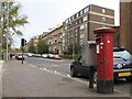
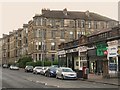
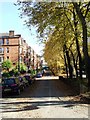
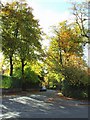
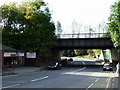
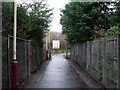
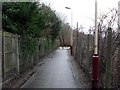
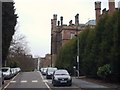
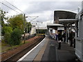
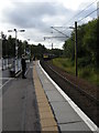
Photos of G12 9TT
Area Information
Living in G12 9TT means residing in a specific residential cluster defined by a single postcode in Scotland. This small area covers just 2,487 square metres, creating an intimate setting within the wider City of Glasgow local authority. The location sits on Dunard Street, an address in Glasgow known for its Victorian and art nouveau architecture stemming from the city's 18th-century trade history. Residents here enjoy proximity to major cultural landmarks without being overwhelmed by the scale of the metropolis. The broader G20 postcode district encompasses several settlements including Forth and Clyde Canal, Lambhill, Possil Park, Ruchill, and Summerston, giving this tiny cluster a strategic position. Glasgow itself is described as a city with rich cultural heritage and a friendly community spirit. The area benefits from excellent transport links and features a mix of amenities including bustling markets, trendy cafes, and beautiful parks such as Glasgow Green. Famous attractions including the Kelvingrove Art Gallery and the city centre are noted as being accessible from the G20 area. For those seeking units on Dunard Street, the location offers a grounded connection to these larger city features while maintaining a distinct residential identity.
- Area Type
- Postcode
- Area Size
- 2487 m²
- Population
- Not available
- Population Density
- Not available
Understanding the housing stock in G12 9TT requires navigating around the absence of specific market statistics for this precise location. No data exists regarding the home ownership percentage or the exact mix of flats and houses within these 2,487 square metres. You cannot determine whether this is primarily an owner-occupied area or a rental market using the available information. The lack of specific figures for this postcode prevents a definitive statement on the prevalence of particular accommodation types. While the broader G20 postcode district encompasses several settlements including Forth and Clyde Canal, Lambhill, Possil Park, Ruchill, and Summerston, no breakdown of property values or landlord occupancy rates accompanies this description. Potential buyers looking at homes in G12 9TT must be prepared to gather information from local estate agents, as the provided dataset does not contain the necessary metrics to characterise the market. The description confirms the area is a specific postcode covering a small residential cluster, but further research beyond the current data is essential to understand the local property landscape fully.
House Prices in G12 9TT
Showing 20 properties
| Address | Type | Beds | Baths | Last Sale Price | Last Sale Date | |
|---|---|---|---|---|---|---|
| Flat 1/1, 57 Queensborough Gardens, Glasgow, G12 9TT | Flat | 2 | 3 | - | - | |
| Flat 3/2, 57 Queensborough Gardens, Glasgow, G12 9TT | Flat | 3 | 2 | - | - | |
| Flat 0/2, 57 Queensborough Gardens, Glasgow, G12 9TT | Flat | 3 | 2 | - | - | |
| Flat 3/1, 71 Queensborough Gardens, Glasgow, G12 9TT | Flat | - | - | - | - | |
| Flat 2/1, 71 Queensborough Gardens, Glasgow, G12 9TT | Flat | - | - | - | - | |
| Flat 2/1, 57 Queensborough Gardens, Glasgow, G12 9TT | Flat | - | - | - | - | |
| Flat 3/1, 57 Queensborough Gardens, Glasgow, G12 9TT | Flat | - | - | - | - | |
| Flat 2, 59 Queensborough Gardens, Glasgow, G12 9TT | Flat | - | - | - | - | |
| Flat 1/2, 57 Queensborough Gardens, Glasgow, G12 9TT | Flat | - | - | - | - | |
| 63 Queensborough Gardens, Glasgow, G12 9TT | Flat | - | - | - | - |
Energy Efficiency in G12 9TT
Your daily life in G12 9TT is defined by immediate access to extensive transport and retail networks within practical reach. You have five railway stations close by, including Hyndland, Partick, and Jordanhill Railway Station. This provides straightforward access to the wider Glasgow network. Five metro stations lie nearby, such as Kelvinhall, Hillhead, and Govan Underground Station. These link directly to the city centre and other key destinations. You also have five ferry landing points accessible, including Riverside Museum Ferry Landing, Govan Ferry Landing, and Glasgow Science Centre North Quay. This variety offers alternative travel options across the river. One airport, Glasgow International Airport, is within reach, facilitating national travel. For daily shopping, five retail options exist, featuring the likes of Sainsburys Glasgow, Sainsburys Partick, and M&S Great Western Road Glasgow BP. The area lies on Dunard Street, where Dunard Primary School operates within the local vicinity on the broader G20 distribution. You are situated near the Forth and Clyde Canal, which runs through the district. Major cultural attractions including the Kelvingrove Art Gallery are cited as being accessible from the G20 area. Glasgow Green is identified as a notable park within the broader city nearby.
Amenities
Schools
| Rank | School | Type | Entry gender | Ages |
|---|
Explore more schools in this area
Go to Schools tabDemographics
The available data outlines the geographic boundaries of G12 9TT rather than providing detailed population statistics for this specific cluster. The area sits at coordinates 55.880282, -4.274442, pinpointing its location within the City of Glasgow local authority in the ceremonial county of Lanarkshire. Without specific figures on age profiles or household types, a detailed demographic breakdown remains outside the scope of current records. Similarly, data regarding home ownership levels, accommodation types, and diversity metrics are not included for this specific postcode. You cannot determine the percentage of owners versus rentees or the age distribution of neighbours within this 2,487 square metre zone based on the information provided. The broader G20 postcode district encompasses several settlements including Forth and Clyde Canal, Lambhill, Possil Park, Ruchill, and Summerston, but no specific household composition data exists for the G12 9TT cluster itself. Consequently, you must rely on general observations of the neighbourhood character rather than hard demographic numbers when evaluating this location.
Household Size
Accommodation Type
Tenure
Ethnic Group
Religion
Household Composition
Age
Household Deprivation
NS-SEC
Explore more demographic insights in this area
Go to Demographics tabPlanning
Planning Constraints
- Flood RiskPremium
- Ramsar Wetland SitesPremium
- Area of Outstanding Natural BeautyPremium
- Protected Nature ReservePremium
- Protected WoodlandPremium
- Crime & SafetyPremium