Area Overview for G12 8PX
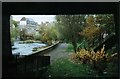
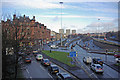
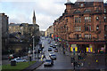
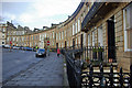
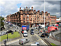
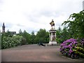
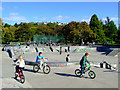
Photos of G12 8PX

Area Information
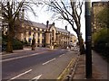
Living in G12 8PX means residing in a specific residential cluster within the broader City of Glasgow local authority. This postcode covers an area of 4992 square metres, defining a small but distinct neighbourhood on Dunard Street. Residents here benefit from the deep cultural heritage and friendly community spirit that characterise Glasgow. The city sits on the River Clyde, drawing on its history of trade and shipbuilding to create an environment rich in Victorian and art nouveau architecture. While G12 8PX is a contained slice of this larger urban landscape, its location places it within the G20 postcode district, which encompasses settlements such as Forth and Clyde Canal, Lambhill, Possil Park, Ruchill, and Summerston. You will find yourself close to major attractions including the Kelvingrove Art Gallery and the bustling Glasgow Green. Daily life is shaped by excellent transport links that connect you to the wider city. The area offers a dynamic blend of history, art, and nightlife that is accessible without leaving the immediate vicinity. Prospective homebuyers should note that this postcode is in the ceremonial county of Lanarkshire, at coordinates 55.880282, -4.274442. It is a modern neighbourhood carved out of a historic city plan, offering convenience rather than rural isolation.
- Area Type
- Postcode
- Area Size
- 4992 m²
- Population
- Not available
- Population Density
- Not available
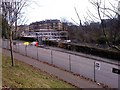
The housing market for G12 8PX is shaped by access to local amenities and transport, though specific home ownership percentages are not provided in the current dataset. This postcode describes a small residential cluster, implying a density typical of urban fringe areas within Glasgow rather than vast detached estates. Buyers should look for homes that leverage the proximity to Hillhead, Kelvinbridge, and Kelvinhall Underground Stations. The lack of specific accommodation type data means you must view properties individually to understand if the stock consists primarily of flats or terraced houses. However, the presence of Dunard Primary School nearby indicates that families consider this address a viable option for schooling. The broader G20 district includes areas like Possil Park and Ruchill, which may offer context on the general housing stock nearby. Since the data does not specify whether this is an owner-occupied or rental market, you must rely on local estate insights to determine tenure. The fixed broadband score of 83 and mobile score of 85 suggest that tech-enabled lifestyles are well-supported. The property market here is likely driven by the convenience of accessing Glasgow Green and the City Centre. Without explicit figures on tenure or均价, the focus remains on the physical accessibility and the quality of life that the seven nearby ferry landings and five rail stations provide to potential residents.
House Prices in G12 8PX
Showing 33 properties
| Address | Type | Beds | Baths | Last Sale Price | Last Sale Date | |
|---|---|---|---|---|---|---|
| Flat 1/1, 29 Hillhead Street, Glasgow, G12 8PX | Flat | 4 | 2 | - | - | |
| Flat 1, 19 Hillhead Street, Glasgow, G12 8PX | Flat | - | - | - | - | |
| Flat 4, 19 Hillhead Street, Glasgow, G12 8PX | Flat | - | - | - | - | |
| Flat 2, 19 Hillhead Street, Glasgow, G12 8PX | Flat | - | - | - | - | |
| Flat 3, 19 Hillhead Street, Glasgow, G12 8PX | Flat | - | - | - | - | |
| Flat 0/1, 27 Hillhead Street, Glasgow, G12 8PX | Flat | - | - | - | - | |
| Flat Basement, 25 Hillhead Street, Glasgow, G12 8PX | Flat | - | - | - | - | |
| Flat Ground, 25 Hillhead Street, Glasgow, G12 8PX | Flat | - | - | - | - | |
| Flat 0/1, 37 Hillhead Street, Glasgow, G12 8PX | Flat | - | - | - | - | |
| Flat B/1, 27 Hillhead Street, Glasgow, G12 8PX | Flat | - | - | - | - |
Energy Efficiency in G12 8PX
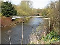
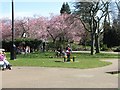
Your daily lifestyle in G12 8PX is defined by immediate access to a wide range of retail, leisure, and transport facilities. You will find five retail outlets nearby, including Spar, Cook Glasgow, and Co-op Glasgow, which handle everyday shopping needs. Leisure options are extensive, with five metro stations providing swift access to Glasgow Green and the city's trendy cafes. The area is close to five railway stations, allowing easy trips to the Exhibition Centre or other cultural sites. For those who enjoy waterways, five ferry landings serve as gateways to attractions like the Plantation Quay and the SECC. Glasgow International Airport is the nearest airport facility for travel abroad. The character of the neighbourhood is shaped by its proximity to Dunard Primary School and the grand Kelvingrove Art Gallery. You can stroll past the historic Forth and Clyde Canal or relax in parks like Glasgow Green if you venture slightly further. The blend of bustling markets and beautiful green spaces creates a balanced environment. Five amenities in each of the metro, rail, and ferry categories ensure you never feel isolated from the city's energy. Living here means having supermarkets, parks, and transport hubs all within practical walking or cycling distance.
Amenities
Schools
| Rank | School | Type | Entry gender | Ages |
|---|
Explore more schools in this area
Go to Schools tabDemographics
Data regarding the specific demographics of G12 8PX is not included in the current profile. The available information focuses on the geographical and infrastructural constraints of the postcode rather than population statistics. You cannot determine the age profile, household types, or home ownership levels for this exact 4992 square metre area from the provided figures. Similarly, details on diversity, deprivation indices, and specific accommodation types are absent from the dataset. While the broader Glasgow city is known for a dynamic mix of communities, stating specific percentages for this cluster would exceed the available data. The profile instead highlights the physical safety environment, noting low flood risk and the absence of planning constraints like protected woodlands or wetlands. Residents face no Ramsar wetland sites or Areas of Outstanding Natural Beauty within their immediate boundary. The digital connectivity scores suggest a high-functioning environment, with fixed broadband and mobile coverage rated highly on a scale of 100. Without demographic figures, the community character remains undefined in numbers, though its proximity to Dunard Primary School suggests access to local education. The area functions as a residential hub where specific household compositions are not statistically defined in this report.
Household Size
Accommodation Type
Tenure
Ethnic Group
Religion
Household Composition
Age
Household Deprivation
NS-SEC
Explore more demographic insights in this area
Go to Demographics tabPlanning
Planning Constraints
- Flood RiskPremium
- Ramsar Wetland SitesPremium
- Area of Outstanding Natural BeautyPremium
- Protected Nature ReservePremium
- Protected WoodlandPremium
- Crime & SafetyPremium