Area Overview for G12 8AN
Photos of G12 8AN


Area Information
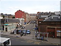
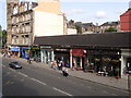
Living in G12 8AN means inhabiting a small, tightly defined postcode area in Scotland, covering 440 square metres. This compact residential cluster is part of a broader network of communities with easy access to urban infrastructure. While the area itself is modest in size, it benefits from proximity to Glasgow’s transport arteries and amenities. The postcode lies within a region characterised by a mix of residential and light commercial activity, with residents likely to be commuters or professionals seeking proximity to city services. Daily life here is shaped by the surrounding infrastructure, including multiple transport hubs and retail options. The area’s small footprint suggests a focused, perhaps family-oriented community, though specific demographic details are not provided. For those prioritising connectivity and convenience, G12 8AN offers a base near key urban amenities, though its scale means it is more of a satellite to larger Glasgow districts than a standalone neighbourhood.
- Area Type
- Postcode
- Area Size
- 440 m²
- Population
- Not available
- Population Density
- Not available
House Prices in G12 8AN
Showing 1 properties
| Address | Type | Beds | Baths | Last Sale Price | Last Sale Date | |
|---|---|---|---|---|---|---|
| 326 Byres Road, Glasgow, G12 8AN | retail_financial | - | - | - | - |
Energy Efficiency in G12 8AN
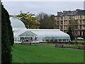
G12 8AN’s proximity to amenities enhances its appeal. Retail options include major chains like Tesco Glasgow, M&S Byres Rd, and Waitrose Byres, ensuring everyday shopping needs are met. Transport links to Glasgow’s cultural and commercial hubs mean residents can access attractions like the Kelvingrove Art Gallery and Glasgow Green with ease. The area’s ferry services provide scenic routes along the Clyde, while rail and metro connections facilitate quick commutes. Though specific parks or leisure facilities within G12 8AN are not detailed, its location near Glasgow’s green spaces and historical sites suggests a lifestyle enriched by urban culture and natural settings. The combination of retail, transport, and proximity to Glasgow’s landmarks makes daily life here both convenient and varied.
Amenities
Schools
| Rank | School | Type | Entry gender | Ages |
|---|
Explore more schools in this area
Go to Schools tabDemographics
Household Size
Accommodation Type
Tenure
Ethnic Group
Religion
Household Composition
Age
Household Deprivation
NS-SEC
Explore more demographic insights in this area
Go to Demographics tabPlanning
Planning Constraints
- Flood RiskPremium
- Ramsar Wetland SitesPremium
- Area of Outstanding Natural BeautyPremium
- Protected Nature ReservePremium
- Protected WoodlandPremium
- Crime & SafetyPremium