Area Overview for G12 0BU
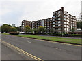
Photos of G12 0BU


Area Information
G12 0BU represents a specific residential cluster within the City of Glasgow local authority on the outskirts of Lanarkshire. This postcode covers just 2967 m², creating a compact living environment for those seeking proximity to major urban amenities without the density of the city centre. The location sits firmly within the broader Glasgow area, benefiting from its rich cultural heritage and friendly community spirit. Residents enjoy easy access to landmarks such as the Kelvingrove Art Gallery and Glasgow Green, which shape the daily rhythm of life. The area is part of a dynamic region known for Victorian and art nouveau architecture, stemming from its historical involvement in trade and shipbuilding along the River Clyde. Daily life here involves navigating a mix of residential pockets that are well-connected to the wider city infrastructure. You will find yourself living in an area where practicality meets historical significance. The small footprint means every street is within a short walk of broader services, allowing you to move efficiently between home and work or leisure. This specific cluster offers a grounded experience of Scottish city living, where residents appreciate the balance between accessible urban culture and a defined, localised neighbourhood setting.
- Area Type
- Postcode
- Area Size
- 2967 m²
- Population
- Not available
- Population Density
- Not available
The housing market in G12 0BU is characterised by a specific location that functions as a small residential cluster within the larger Glasgow landscape. There is no specific data available regarding the percentage of owner-occupied homes or the number of rental properties within this exact postcode sector. Consequently, it is impossible to state definitively whether this area is primarily an owner-occupied community or a rental hub based on the current figures. The broader G20 postcode district, which encompasses G12 0BU, includes settlements such as Possil Park and Ruchill, suggesting a mix of residential options typical of the City of Glasgow. Without specific statistics on accommodation types for this 2967 m² area, buyers cannot determine if they are looking at period properties, modern flats, or detached homes in this cluster. The absence of home ownership percentages means the property market feels less analysed at this microscopic level. You should approach viewing homes in G12 0BU with the understanding that the stock is likely varied given its proximity to major roads and stations. The market dynamics here are tied to its connectivity rather than a distinct local housing bubble. Buyers interested in this postcode must look beyond the specific data to understand the prevailing tenures of this small, defined residential zone.
House Prices in G12 0BU
Showing 6 properties
Energy Efficiency in G12 0BU
Living in G12 0BU places you within striking distance of a wide array of retail and transport options. You have immediate access to five retail outlets, including Spar, M&S Great Western Rd Glasgow BP, and Lidl Crow, ensuring your weekly shopping needs are met with convenience. Your daily commute is well-supported by five railway stations, specifically Anniesland Railway Station, Jordanhill Railway Station, and Kelvindale Railway Station, which offer direct routes into the city and beyond. For those who prefer the underground network, five metro stations are available, including Hillhead Underground Station, Kelvinhall Underground Station, and Kelvinbridge Underground Station. If you enjoy water-based travel, five ferry landings are nearby, such as the Riverside Museum Ferry Landing and the Govan Ferry Landing, providing unique scenic routes. Glasgow International Airport is also just one stop away, making travel simple. The area benefits from the broader character of Glasgow, a city known for its bustling markets and trendy cafes. You can walk from this postcode to enjoy the Forth and Clyde Canal, which runs through the surrounding G20 district. The proximity to Dunard Primary School and Glasgow Green adds to the family-friendly appeal. Your lifestyle here is defined by this rich network of public transport and essential services.
Amenities
Schools
| Rank | School | Type | Entry gender | Ages |
|---|
Explore more schools in this area
Go to Schools tabDemographics
You can expect to live in G12 0BU without having extensive data on age profiles, household types, or deprivation indices available for this specific postcode. The provided information does not include statistics on the diversity of the community or specific numbers regarding home ownership levels for this cluster. Similarly, there is no recorded information on the types of accommodation prevalent within these boundaries or the breakdown of single-person versus multi-person households. Because the area is a small residential cluster, broad demographic figures often apply to the larger G20 district rather than this precise location. Living in G12 0BU means you are in an area where detailed community statistics are not currently published in the available records. This lack of granular data prevents a full picture of the neighbourly ties or economic status of the current residents. While the broader City of Glasgow is known for a dynamic blend of history and art, the specific sociological makeup of this postcode remains outside the scope of the current dataset. Homebuyers would need to rely on physical visits or wider district trends to infer the typical resident profile. The absence of specific figures on age or income suggests that the area may serve a varied demographic, though the exact proportions remain unrecorded in the information at hand.
Household Size
Accommodation Type
Tenure
Ethnic Group
Religion
Household Composition
Age
Household Deprivation
NS-SEC
Explore more demographic insights in this area
Go to Demographics tabPlanning
Planning Constraints
- Flood RiskPremium
- Ramsar Wetland SitesPremium
- Area of Outstanding Natural BeautyPremium
- Protected Nature ReservePremium
- Protected WoodlandPremium
- Crime & SafetyPremium