Area Overview for G1 2HH
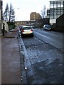
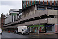
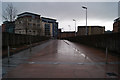
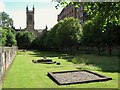
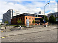
Photos of G1 2HH


Area Information
G1 2HH is a small residential postcode in Glasgow, Scotland, situated within the City of Glasgow local authority. This area is part of a broader network of settlements, including Possil Park, Ruchill, and Summerston, all of which are connected to the River Clyde, a historic waterway central to Glasgow’s 18th-century trade and shipbuilding legacy. The postcode covers a compact cluster of homes, with a mix of Victorian and art nouveau architecture reflecting the city’s rich cultural heritage. Living here means being part of a community with a friendly, dynamic character, known for its accessible markets, trendy cafes, and proximity to green spaces like Glasgow Green. The area is well-served by transport links, including underground stations, rail services, and ferry terminals, making it convenient for commuters and those who enjoy urban living. Glasgow’s reputation as a hub for art, culture, and nightlife is also within reach, with attractions like the Kelvingrove Art Gallery nearby. For those seeking a balance between city life and community spirit, G1 2HH offers a distinct blend of practicality and charm.
- Area Type
- Postcode
- Area Size
- Not available
- Population
- Not available
- Population Density
- Not available
House Prices in G1 2HH
No properties found in this postcode.
Energy Efficiency in G1 2HH
Daily life in G1 2HH is enriched by a range of nearby amenities. Retail options include major chains like M&S Glasgow Queen and Tesco Glasgow, offering everything from groceries to clothing. The area’s transport hubs also serve as gateways to Glasgow’s vibrant cultural scene, with the Kelvingrove Art Gallery and city centre within easy reach. Parks such as Glasgow Green provide green space for relaxation and recreation. For dining, the proximity to trendy cafes and markets reflects the city’s lively food culture. Leisure opportunities are further enhanced by the Forth and Clyde Canal, which runs through the G20 postcode district, offering scenic walks and water-based activities. The presence of Dunard Primary School and accessible public transport ensures families have both educational and practical needs met. This mix of retail, cultural, and recreational facilities creates a convenient, well-rounded lifestyle for residents.
Amenities
Schools
| Rank | School | Type | Entry gender | Ages |
|---|
Explore more schools in this area
Go to Schools tabDemographics
Household Size
Accommodation Type
Tenure
Ethnic Group
Religion
Household Composition
Age
Household Deprivation
NS-SEC
Explore more demographic insights in this area
Go to Demographics tabPlanning
Planning Constraints
- Flood RiskPremium
- Ramsar Wetland SitesPremium
- Area of Outstanding Natural BeautyPremium
- Protected Nature ReservePremium
- Protected WoodlandPremium
- Crime RiskPremium