Area Overview for Newburgh (Fife)
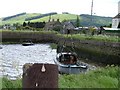
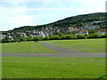
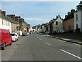
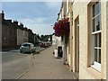
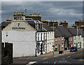
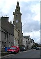
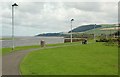
Photos of Newburgh (Fife)


Area Information
Living in Newburgh (Fife) defines a specific experience within the Scottish Borders. You will find yourself settled in a built-up area comprising 72.4 hectares, substantial enough to support community facilities yet compact enough to maintain a close-knit feel. This district lies within the broader county of Fife, placing it in a region known for ancient stone architecture and rolling landscapes. While Newburgh (Fike) lacks the extensive infrastructure of a major city, its defined boundaries create a clear sense of place. Residents here enjoy access to a rural setting that retains the practical convenience of a developed locale. The scale of the area suggests a environment where local knowledge travels quickly and where neighbours interact frequently. Daily life revolves around shared spaces and proximity to neighbouring villages. The compact nature of this 72.4-hectare settlement means you do not need to travel far to reach the heart of your community. This balance between size and accessibility makes Newburgh (Fife) a distinct choice for those who value a settled, defined home life over urban sprawl.
- Area Type
- Built Up Area 250
- Area Size
- 72.4 hectares
- Population
- Not available
- Population Density
- Not available
Daily life in Newburgh (Fife) revolves around a selection of amenities located within practical reach of your residence. You will find four retail options scattered around the area to meet basic shopping needs. key venues include the Co-op Newburgh, the Spar, and the Co-op Auchtermuchty, which serves those who wish to travel slightly further for their groceries and household goods. These high street staples provide essential convenience for buying food and daily necessities without the need to drive to major commercial centres. While the retail selection is manageable for everyday living, it reflects the semi-rural nature of this Scottish settlement. The presence of the Co-op Auchtermuchty demonstrates that services extend just outside the immediate township limits. Residents can manage their shopping trips locally, maintaining a balance between self-sufficiency and access to further towns. This configuration makes Newburgh (Fife) suitable for those who value convenience but do not require a full suite of urban retail outlets. Your routine will likely include regular visits to these local shops.
Amenities
Schools
| Rank | School | Type | Entry gender | Ages |
|---|
Explore more schools in this area
Go to Schools tabDemographics
The community profile in Newburgh (Fife) reflects a settlement with specific housing and ownership characteristics. A significant portion of the population consists of owner-occupiers, standing at 78%. This figure indicates that the majority of households in this area have long-term stability and are settled for the future. The remaining market involves private renting, making up 11% of the total. Social renting accounts for a further 1% of the accommodation. With such a high rate of home ownership, you can expect a neighbourhood where residents are likely to know one another and invest time in local improvements. The low level of private renting suggests the area is not characterised by transient populations or short-term leases. This demographic stability creates an environment where families and long-term couples form the core of the community. The 78% ownership rate also implies that you will often find established households rather than new arrivals. Consequently, the social fabric of Newburgh (Fife) relies on deep roots rather than fluid population shifts. When you consider homes in Newburgh (Fife), you are entering a space defined by resident commitment.
Household Size
Accommodation Type
Tenure
Ethnic Group
Religion
Household Composition
Age
Household Deprivation
NS-SEC
Explore more demographic insights in this area
Go to Demographics tabPlanning
Planning Constraints
- Crime & SafetyPremium