Area Overview for Leven (Fife)
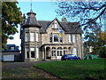
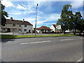
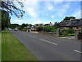
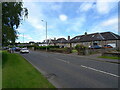
Photos of Leven (Fife)

Area Information
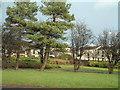
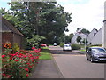
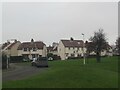
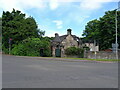
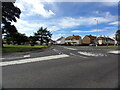
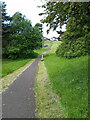
Living in Leven (Fife) offers a distinct lifestyle within a seaside resort town located in the urban Levenmouth conurbation. This built-up area spans 3.4 km² along the coast of the Firth of Forth at the mouth of the River Leven. You are situated 8.1 miles north-east of Kirkcaldy and 6.4 miles east of Glenrothes. The population stands at 10,087 people, rising to 37,651 when considering the wider conurbation. This area forms part of east Central Lowlands of Scotland and balances the history of a once popular resort with modern renewal initiatives. The community values long sandy beaches, big skies, and sweeping waters. You will find an attractive beach promenade with playparks and kids' facilities integrated into the daily landscape. The town forms part of the 150-mile Fife Coastal Path, ensuring access to significant walking networks. Historically, the name derives from the Pictish word for flood, linked to nearby Loch Leven. The settlement evolved from a parish church gift in the mid-11th century to a police burgh in 1867. Recent developments include the reopening of the Leven Railway station on 2 June 2024. This infrastructure change supports the town's character as a place experiencing renewal while maintaining tight-knit community bonds.
- Area Type
- Built Up Area 250
- Area Size
- 3.4 km²
- Population
- Not available
- Population Density
- Not available
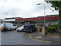
Your lifestyle in Leven (Fife) revolves around coastal access and local amenities. You have five retail options within practical reach, including Morrisons Daily, Aldi Leven, and Sainsburys Leven. These supermarkets provide daily necessities without requiring a long drive. For leisure, the beach promenade features playparks and kids' facilities near the sandy beaches. You can walk the 150-mile Fife Coastal Path starting directly from the seaside resorts. Letham Glen offers a crafts centre and woodland walks, while Silverburn provides gardens and coastal views. The historic Leven Parish Church stands as a landmark near the centre. Active travel enthusiasts can utilise the Fife Coastal Path for exercise and tourism. The Fife Heritage Railway runs near Burnmill industrial estate, featuring Santa specials during the festive period. All these facilities are integrated within the town's 3.4 km² boundary or immediate surroundings. Commuters can easily reach other stations like Markinch or Cameron Bridge Railway Station if needed. You willfind a mix of historic and modern amenities supporting a balanced daily life.
Amenities
Schools
| Rank | School | Type | Entry gender | Ages |
|---|
Explore more schools in this area
Go to Schools tabDemographics
The community in Leven (Fife) represents a standard built-up population of 10,087 residents counted during the 2022 census. This figure includes households living in a defined town environment within the Firth of Forth region. The demographic profile reflects a mix of families and individuals drawn to the coastal location and established amenities. You will find a concentration of residents who utilise the local parks and heritage sites as part of their daily routine. Accommodation types are distributed across a 3.4 km² footprint, supporting the needs of those working in local industries or commuting to Edinburgh and Kirkcaldy. The area is part of the larger Levenmouth conurbation, which houses 37,651 people total. This density provides a metropolitan feel without leaving the coastal setting. The population structure supports local services ranging from retail outlets to rail connections. Residents benefit from a community size that maintains recognizable neighbourhood dynamics while offering access to broader regional facilities. The census data confirms the town's status as a significant residential hub in east Central Lowlands of Scotland.
Household Size
Accommodation Type
Tenure
Ethnic Group
Religion
Household Composition
Age
Household Deprivation
NS-SEC
Explore more demographic insights in this area
Go to Demographics tabPlanning
Planning Constraints
- Crime & SafetyPremium