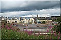
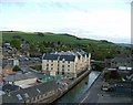
Area Overview for KY15 4HN
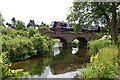
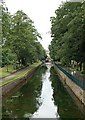
Photos of KY15 4HN


Area Information
KY15 4HN is a small residential postcode area in Scotland, characterised by its compact layout and proximity to key services. The area is served by multiple retail outlets, including Lidl Cupar, Co-op Cupar, and Tesco Cupar, which provide everyday shopping convenience. Residents have access to four nearby railway stations—Cupar, Springfield, Ladybank, and one unnamed station—facilitating easy travel to larger towns and cities. Digital connectivity is excellent, with a broadband score of 99 and a mobile coverage score of 84, ensuring reliable internet for both work and leisure. The area’s small size means a close-knit community feel, with amenities and services within practical reach. While the postcode covers a limited geographical footprint, its strategic location offers a balance between rural tranquillity and accessible urban connectivity. This makes KY15 4HN appealing to those seeking a quieter lifestyle without sacrificing convenience. The absence of significant environmental constraints, such as protected woodlands or Ramsar sites, means development and living here is largely unencumbered by planning restrictions. For buyers, this area offers a blend of practicality and simplicity, ideal for those prioritising ease of access to essential services and a low-risk environment.
- Area Type
- Postcode
- Area Size
- Not available
- Population
- Not available
- Population Density
- Not available
House Prices in KY15 4HN
No properties found in this postcode.
Energy Efficiency in KY15 4HN
Living in KY15 4HN offers access to a range of nearby amenities that support daily life. The area is served by five retail outlets, including major supermarkets such as Lidl Cupar, Co-op Cupar, and Tesco Cupar, ensuring residents can easily access groceries, household goods, and other essentials. These shops are within walking or short driving distance, reducing the need for long journeys. The presence of four railway stations—Cupar, Springfield, Ladybank, and another unnamed station—provides easy access to public transport, connecting residents to broader regional networks. While the area’s small size means fewer large-scale leisure facilities, the proximity to rail services and retail hubs suggests a lifestyle focused on convenience and practicality. The absence of significant natural or protected areas means the environment is more subdued, with fewer recreational opportunities than more rural or coastal locations. However, the ease of access to nearby towns via rail compensates for this, allowing residents to enjoy a wider range of cultural and leisure activities beyond the immediate area.
Amenities
Schools
| Rank | School | Type | Entry gender | Ages |
|---|
Explore more schools in this area
Go to Schools tabDemographics
Household Size
Accommodation Type
Tenure
Ethnic Group
Religion
Household Composition
Age
Household Deprivation
NS-SEC
Explore more demographic insights in this area
Go to Demographics tabPlanning
Planning Constraints
- Flood RiskPremium
- Ramsar Wetland SitesPremium
- Area of Outstanding Natural BeautyPremium
- Protected Nature ReservePremium
- Protected WoodlandPremium
- Crime & SafetyPremium