Area Overview for KY10 2NW
Photos of KY10 2NW
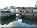
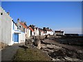
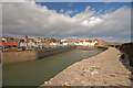
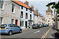
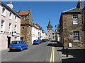
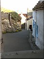
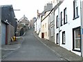
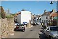
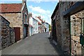
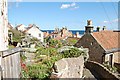
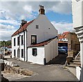
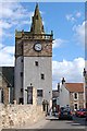
100 photos from this area
Area Information
Key information about the KY10 2NW including its size, population, and administrative classification.
- Area Type
- Postcode
- Area Size
- 7.1 hectares
- Population
- Not available
- Population Density
- Not available
House Prices in KY10 2NW
11
Properties
-
Average Sold Price
-
Lowest Price
-
Highest Price
Showing 11 properties
| Address | Type | Beds | Baths | Last Sale Price | Last Sale Date | |
|---|---|---|---|---|---|---|
| 37 Mid Shore, Pittenweem, KY10 2NW | Unknown | - | - | - | - | |
| Tanks At Pittenweem Harbour, Mid Shore, Pittenweem, KY10 2NW | Industrial | - | - | - | - | |
| 38 Mid Shore, Pittenweem, KY10 2NW | Unknown | - | - | - | - | |
| 40 Mid Shore, Pittenweem, KY10 2NW | Unknown | - | - | - | - | |
| House On The Rock, 42 Mid Shore, Pittenweem, KY10 2NW | house | - | - | - | - | |
| Harbour P C, Mid Shore, Pittenweem, KY10 2NW | commercial | - | - | - | - | |
| Fishbox Storage Yard, Mid Shore, Pittenweem, KY10 2NW | Industrial | - | - | - | - | |
| Pittenweem Fish Market, Mid Shore, Pittenweem, KY10 2NW | general_industrial | - | - | - | - | |
| Pittenweem Harbour, East Shore, Pittenweem, KY10 2NW | Leisure | - | - | - | - | |
| Ice Plant, Pittenweem Fish Market, Mid Shore, Pittenweem, KY10 2NW | Retail | - | - | - | - |
Page 1 of 2
Energy Efficiency in KY10 2NW
Amenities
Schools
| Rank | School | Type | Entry gender | Ages |
|---|
Explore more schools in this area
Go to Schools tabDemographics
Household Size
N/A
most common
Accommodation Type
N/A
most common
Tenure
N/A
majority
Ethnic Group
N/A
most common
Religion
N/A
most common
Household Composition
N/A
most common
Age
N/A
median
N/A
most common
Household Deprivation
N/A
with no deprivation
NS-SEC
N/A
in Lower managerial occupations
Explore more demographic insights in this area
Go to Demographics tabPlanning
Planning Constraints
- Flood RiskPremium
- Ramsar Wetland SitesPremium
- Area of Outstanding Natural BeautyPremium
- Protected Nature ReservePremium
- Protected WoodlandPremium
- Crime & SafetyPremium