Area Overview for Kirkcaldy
Photos of Kirkcaldy


Area Information
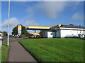
Kirkcaldy is a built-up area in Scotland spanning 15.3 km². It operates as a significant town within the wider region, offering a perspective on daily life that balances community proximity with practical amenities. Living in Kirkcaldy means gaining access to a dense environment where facilities are within practical reach. The area provides a clear setting for those seeking a location with established retail and transport links. You will find the infrastructure supports a town-level experience without the sprawl of larger cities. This structure defines the character of homes in Kirkcaldy, ensuring that essential services remain close to the houses you buy. The layout facilitates straightforward commutes and easy access to local services. Residents experience a neighbourhood defined by its connectivity and size. You gain immediate access to major retail outlets and railway stations that anchor the town's function. This setting suits individuals looking for a straightforward place to live where daily needs are met without excessive travel. The compact nature of the 15.3 km² footprint ensures that the community remains accessible from most parts of the town.
- Area Type
- Built Up Area 250
- Area Size
- 15.3 km²
- Population
- Not available
- Population Density
- Not available
Your lifestyle in Kirkcaldy benefits from practical proximity to key amenities. Five retail outlets lie within easy reach, including Co-op Kirkcaldy, Asda Kirkcaldy, and a second Co-op location. These stores handle your weekly grocery and shopping needs efficiently. For travel, you have access to five railway stations outside the immediate area. Kirkcaldy Railway Station serves as the primary hub, linking you to wider networks. Glenrothes with Thornton Railway Station and Cardenden Railway Station offer additional rail connections within practical reach. This density of transport links means you rarely need a car for regional travel. You can attend meetings, travel for work, or visit friends using the rail system without long delays. The presence of multiple supermarkets and railways creates a convenient routine. Living in Kirkcaldy allows you to combine independent shopping with efficient rail transport. This setup reduces daily hassle and maximises your use of public networks. The town is designed so that these amenities are never far away.
Amenities
Schools
| Rank | School | Type | Entry gender | Ages |
|---|
Explore more schools in this area
Go to Schools tabDemographics
The provided information on demographics for Kirkcaldy includes specific measures of safety and digital infrastructure rather than population breakdowns. Crime risk data is currently only available for areas in England, so no specific safety rating exists for this Scottish town in the current dataset. This absence means you cannot rely on quantitative crime statistics for Kirkcaldy at this time. However, the area's digital connectivity offers a clear window into community capabilities. Fixed broadband scores a 96 out of 100, indicating excellent quality for internet-dependent tasks. Mobile coverage reaches 84 out of 100, providing strong network reliability for residents. These high connectivity scores suggest the area supports modern lifestyles effectively. While age profiles and household types are not included in the available data, the robust digital infrastructure points toward a community well-equipped for remote work and online services. You should note that specific deprivation metrics or school ranking data are also absent from the current records. The focus remains on the verified strengths of connectivity and the acknowledged limitations regarding English-only crime data.
Household Size
Accommodation Type
Tenure
Ethnic Group
Religion
Household Composition
Age
Household Deprivation
NS-SEC
Explore more demographic insights in this area
Go to Demographics tabPlanning
Planning Constraints
- Crime & SafetyPremium