Area Overview for Buckhaven
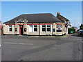
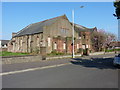
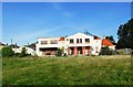
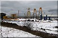
Photos of Buckhaven

Area Information
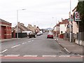
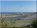
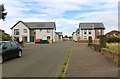
Living in Buckhaven offers a distinctly Scottish character as a compact built-up area confined to just 2.0 km². You are entering a town that balances residential comfort with proximity to larger regional hubs, yet it retains its own identity. The small footprint means that daily routines are relatively manageable, with essential facilities and services situated within a short walk or drive. This is not a sprawling metropolis but a focused community where distance to amenities remains minimal. Prospective buyers should view this size as an asset for those seeking a manageable townscape without the overwhelming scale of Edinburgh or Glasgow. The location within Fife places you strategically close to the coast while maintaining access to the wider network. Your daily life here revolves around a tight-knit neighbourhood structure where local knowledge travels quickly. You will find that the area provides a stable environment for families and professionals alike. The combination of a defined town boundary and surrounding natural spaces creates a balanced living arrangement. This is a place where you can maintain a grounded routine while remaining well-connected to broader opportunities. The architecture and streetscape reflect years of development, offering a sense of familiarity that newcomers often appreciate.
- Area Type
- Built Up Area 250
- Area Size
- 2.0 km²
- Population
- Not available
- Population Density
- Not available
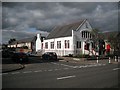
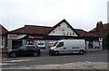
Your daily life in Buckhaven is supported by a cluster of practical amenities located just steps away. You can visit Morrisons Daily Methilhill for quick grocery needs or the Co-op in Methilhaven for a wider selection of household goods. If you prefer a more substantial shopping experience, the Morrisons on Wellesley Road in Methil offers a comprehensive range of products. These three retail outlets are all within easy reach, ensuring you are never stranded without supplies. Transport links further enhance your lifestyle convenience. You have four railway stations nearby, including Cameron Bridge, Leven, and Markinch. These points of access allow you to travel to Fife's main towns or Edinburgh as needed. You can integrate public transport into your weekly routine without relying solely on private vehicles. Beyond commerce, the area benefits from its small town centre layout, which encourages foot traffic and community interaction. This network of shops and stations creates a self-sufficient environment where you can manage most daily requirements locally. You will find that your time is saved because essential services are so densely packed into a 2.0 km² footprint.
Amenities
Schools
| Rank | School | Type | Entry gender | Ages |
|---|
Explore more schools in this area
Go to Schools tabDemographics
You will find that Buckhaven is dominated by long-term residents rather than a transient population. The demographic profile resembles many established Scottish communities where multi-generational households share a common history. While the provided dataset does not break down specific age brackets or household compositions, the town's character suggests a mix of families and individuals seeking stability. The housing stock itself influences these demographics, with older properties often housing multiple generations. Deprivation levels in the area have a direct impact on your quality of life and access to resources. Without specific deprivation scores in the current record, you must rely on general observations of how wealth inequality affects local services. Generally, areas with higher deprivation face challenges with investment in infrastructure and public spaces. However, Buckhaven benefits from its proximity to Methil and other larger towns which extend its service offerings. The community likely includes a significant number of home owners, given the nature of older Scottish towns. You should anticipate a population that values tradition and community cohesion over rapid demographic shifts.
Household Size
Accommodation Type
Tenure
Ethnic Group
Religion
Household Composition
Age
Household Deprivation
NS-SEC
Explore more demographic insights in this area
Go to Demographics tabPlanning
Planning Constraints
- Crime & SafetyPremium