Area Overview for Ballingry and Lochore
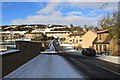
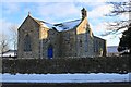
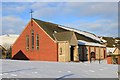
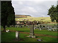
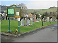
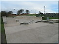
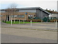
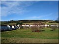
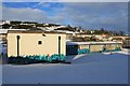
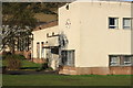
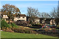
Photos of Ballingry and Lochore

Area Information
Ballingry and Lochore stands as a built-up area of 1.4 square kilometres, offering a compact footprint for those seeking a defined community setting in Fife. Living here means navigating a landscape that is firm in its identity, neither sprawling nor densely packed. The area covers a specific section of the wider local landscape, serving residents who value proximity to essential services within a manageable distance. You will find that daily life revolves around a tangible sense of place, where the boundaries of the locality are clear and the community feels contained. This small size ensures that distances to key facilities remain short, reducing the time spent commuting locally. The character of this neighbourhood is rooted in practicality and local connectivity. Homes in Ballingry and Lochore offer a connection to the broader transport network while maintaining a quieter residential feel compared to larger towns. The area functions as a distinct node within the local geography, providing a base for those working in nearby industrial or commercial zones. It is a place where the rhythm of daily life is set by the immediate surroundings rather than distant hubs. Prospective buyers looking for a concrete sense of location will find this built-up area delivers that specific atmosphere without the chaos of a major city center.
- Area Type
- Built Up Area 250
- Area Size
- 1.4 km²
- Population
- Not available
- Population Density
- Not available
Living in Ballingry and Lochore places you within practical reach of essential amenities that support a convenient daily routine. Five retail outlets are situated nearby, offering convenient shopping options for your regular needs. You have access to Co-op Lochore, Co-op Lochgelly, and Morrisons Daily, ensuring you can stock up on groceries and essentials without excessive travel. These specific venues anchor the local shopping scene, providing the staple services required by households in this district. Transport links further enhance your lifestyle through an accessible network of three railway stations. Lochgelly Railway Station, Cardenden Railway Station, and Cowdenbeath Railway Station stand ready to take you to wider destinations. Additionally, the area benefits from access to two ferry services. The Lochleven Castle Ferry Landing and the Kinross Ferry Landing are the designated points for water-based transport, linking you to other parts of the region. These five named transport hubs and shops form the core of your practical environment. While the area is compact, these provided facilities ensure that basic needs are met without deep commutes. The presence of these specific named amenities creates a functional community hub. You will find that the immediate vicinity supports a mix of daily errands and regional travel needs. The concentration of these services within easy reach defines the character of life in Ballingry and Lochore.
Amenities
Schools
| Rank | School | Type | Entry gender | Ages |
|---|
Explore more schools in this area
Go to Schools tabDemographics
Specific demographic figures such as age profiles, household types, or deprivation indices are not included in the available information for this locality. Consequently, there are no precise statistics regarding the diversity of residents or the specific age groups that make up the population of Ballingry and Lochore. Without these detailed breakdowns, it is impossible to state definitively how households are structured or what levels of home ownership exist within the community. This absence of granular data means you cannot rely on numerical trends to understand who currently lives here. You may need to make decisions based on the area's general reputation rather than hard population statistics. The community composition remains an unknown variable in the current dataset. While you cannot see exact figures, the nature of the built-up area suggests a residential focus. You should anticipate that the community may reflect the broader regional trends of Fife, but local specifics remain unrecorded in this print. Buyers must approach the social makeup of Ballingry and Lochore with an understanding that detailed demographic evidence is not present in the current records.
Household Size
Accommodation Type
Tenure
Ethnic Group
Religion
Household Composition
Age
Household Deprivation
NS-SEC
Explore more demographic insights in this area
Go to Demographics tabPlanning
Planning Constraints
- Crime & SafetyPremium