Area Overview for Aberdour
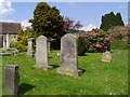
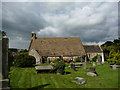
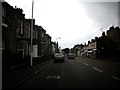
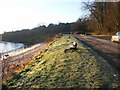
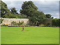
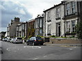
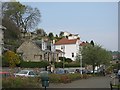
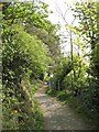
Photos of Aberdour
Area Information
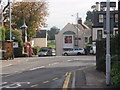
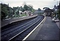
Aberdour is a compact built-up area in Scotland, spanning 66 hectares. Its small size makes it a tightly knit community, with a focus on practical living and access to essential services. The area is well-connected by rail, with five stations nearby, including Aberdour Railway Station, Burntisland, and Dalgety Bay. Ferries also play a key role in local connectivity, offering routes to Inchcolm Island, Town Pier, and Hawes Pier. This mix of transport options suggests a balance between traditional and modern mobility. The area’s broadband score is 100, indicating excellent fixed-line internet quality, while mobile coverage is rated 84, which is good for most daily needs. Though crime data is not available for Scotland, the area’s infrastructure and amenities suggest a practical, accessible lifestyle. Living in Aberdour offers proximity to both urban and coastal features, making it suitable for those seeking a blend of convenience and natural surroundings.
- Area Type
- Built Up Area 250
- Area Size
- 66.0 hectares
- Population
- Not available
- Population Density
- Not available
Aberdour’s lifestyle is shaped by its accessible amenities. Within practical reach are five retail outlets, including Co-op Burntisland, Asda Dalgety, and Aldi Ridge, offering everyday shopping needs. The area’s rail and ferry connections also provide access to leisure opportunities, such as visiting Inchcolm Island or exploring coastal piers. While specific details on dining or parks are not provided, the presence of multiple retail and transport hubs suggests a community focused on convenience and connectivity. The mix of rail, ferry, and retail options supports both daily errands and recreational travel. For residents, this means a lifestyle that balances practicality with the ability to explore nearby attractions. The area’s infrastructure ensures that even in a small built-up space, there are multiple ways to engage with local and regional amenities.
Amenities
Schools
| Rank | School | Type | Entry gender | Ages |
|---|
Explore more schools in this area
Go to Schools tabDemographics
Household Size
Accommodation Type
Tenure
Ethnic Group
Religion
Household Composition
Age
Household Deprivation
NS-SEC
Explore more demographic insights in this area
Go to Demographics tabPlanning
Planning Constraints
- Crime RiskPremium