Area Overview for East Renfrewshire
Photos of East Renfrewshire

Area Information
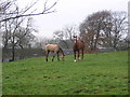
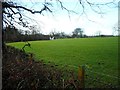
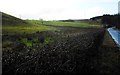
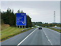
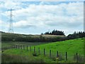
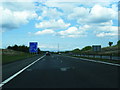
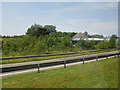
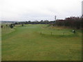
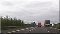
Living in East Renfrewshire offers a distinct character within the Scottish countryside, defined by its status as a local authority district covering 174.3 km². The area attracts residents who value space and a connection to the outdoors, yet they remain mindful of specific environmental considerations. You will find this region is recognised for having parts of protected woodland, a factor that shapes planning and daily life compared to more industrialised zones. While the broader landscape provides a rural setting, you must consider that a portion of the district sits within a zone of medium flood risk. This is not a universal threat, but a tangible fact that any prospective buyer needs to weigh against the desire for a country lifestyle. The district stands apart from urban conurbations with its significant land area, offering a different pace of life than central Edinburgh or Glasgow. However, this remoteness comes with trade-offs regarding digital infrastructure. You will find that while mobile networks provide strong coverage, fixed broadband speeds are considerably lower than national benchmarks. This disconnect between location and connectivity defines the modern experience here; you can be surrounded by nature while facing challenges with high-speed internet. Prospective homebuyers must decide if the rural setting outweighs the potential limitations for working from home or streaming services. The area provides a specific type of living where environmental constraints and connectivity gaps are as defining features as the rolling hills and open skies.
- Area Type
- District/Borough
- Area Size
- 174.3 km²
- Population
- Not available
- Population Density
- Not available
Demographics
The community in East Renfrewshire is shaped by specific demographic realities that influence daily life and local services. You will find that household composition and home ownership levels determine the character of neighbourhoods within this 174.3 km² district. Although detailed age profiles and specific deprivation indices are not available in the current records, the assessment of crime risk cannot be applied to this part of Scotland. Crime statistics are currently restricted to areas in England, meaning you cannot rely on those specific metrics to gauge safety here. This gap in data requires you to place more weight on environmental assessments and personal observation rather than comparative crime figures. Accommodation types vary across the district, reflecting a mix of housing styles suited to both young families and those seeking independent living. The presence of protected woodland suggests an environment where green spaces play a vital role in local planning. You live in an area where nature reserves and woodlands are legally protected, ensuring that certain landscapes remain intact for future generations. This restriction on development can create a stable, changing-demand market. The lack of national deprivation data means you must look at local indicators, such as school access and transport links, to understand the economic health of the community. Every household here operates within a unique regulatory framework that prioritises conservation and safety over the development statistics found in other parts of the UK.
Household Size
Accommodation Type
Tenure
Ethnic Group
Religion
Household Composition
Age
Household Deprivation
NS-SEC
Explore more demographic insights in this area
Go to Demographics tabPlanning
Planning Constraints
- Flood RiskPremium
- Ramsar Wetland SitesPremium
- Area of Outstanding Natural BeautyPremium
- Protected Nature ReservePremium
- Protected WoodlandPremium
- Crime RiskPremium